Whitney in Winter

It’s February 2020. You’re excited. You enter the lottery to get permits to hike Mt Whitney. It’s the highest mountain in the contiguous United States. You’ve never been that high before! In March you find out you’ve got a permit for May. There’s some pandemic thing happening, but that’ll totally be resolved by May. You book campsites at Whitney Portal; you book a few nights before at Onion Valley. You’ve got a team ready to go. Time to kick up the training a notch.

Multiple trips to the San Gabriels, culminating in a summit of San Gorgonio two weeks before you’re due to hike Whitney. You hear rumours of permits getting cancelled. You’re nervous, but optimistic. It’s the week before your hike. Your campsites have been cancelled, but oddly not your permit. It’s 5 days before your planned summit. Your permit is revoked. All permits for the rest of the year are already booked. No dice.

Endure 6 months of pandemic…

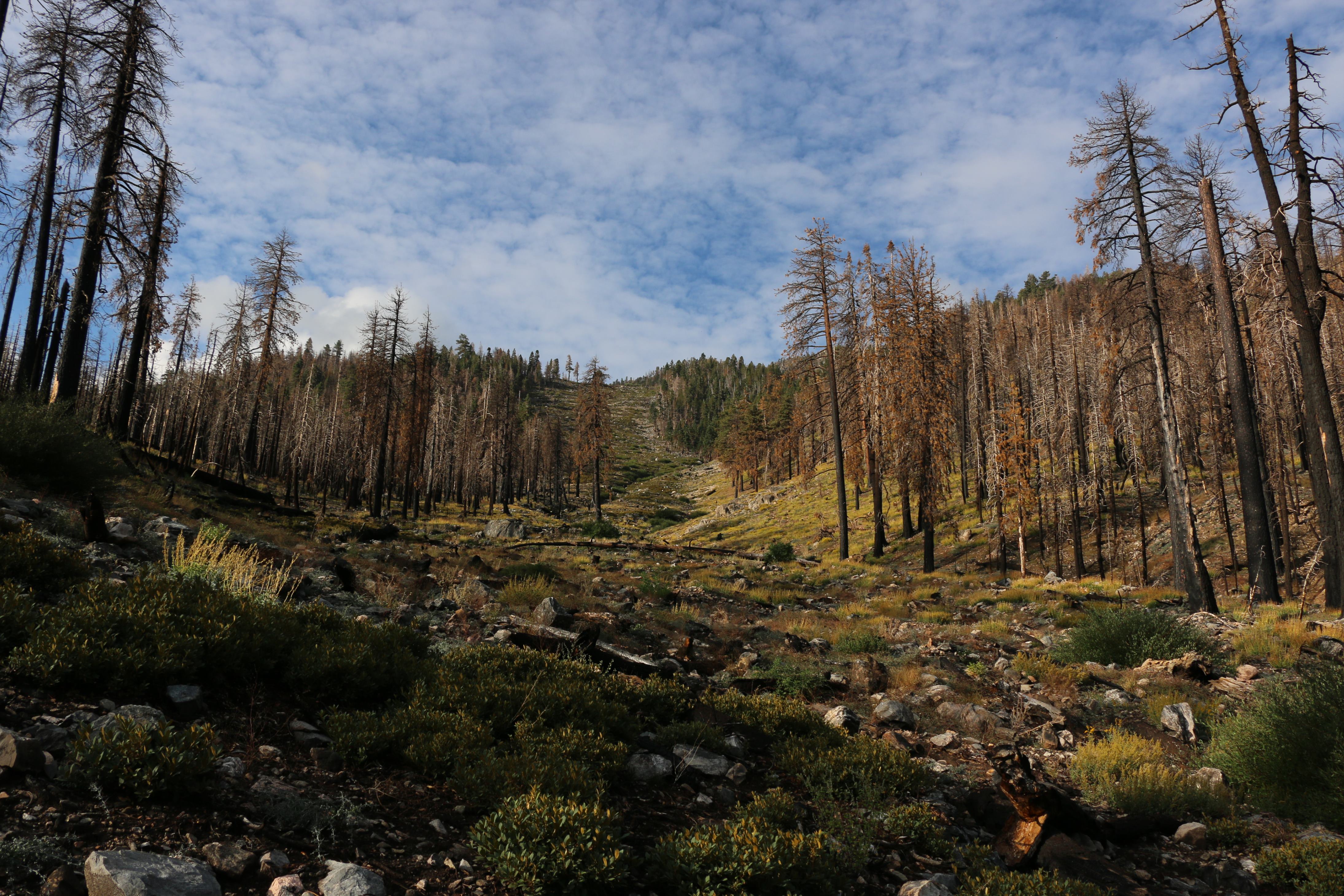
It’s early November 2020, you’re planning on camping up the 395 for the Thanksgiving week. Permit season has ended, but fire season has devastated the Sierras. Whitney’s still closed.

This image has nothing to do with Whitney, I just needed something to intersperse all the words. It’s taken at the Hot Creek Geological Site, just outside Mammoth Lakes, CA

It’s two weeks before your trip; Whitney is open; permits are being offered for the following week. Ooh. You wait patiently for the week to finish and the following week’s worth of permits to be released. They aren’t…

It’s Wednesday, your trip is planned to start on Sunday. Still no permits for the following week. You phone, they acknowledge its odd, but claim permits will be up the next day most likely. Next day, no permits. You phone Friday, this time they open a reservation spot just for you. You claim the reservation! You phone back minutes later to get them to email you your permit. They do! You have a permit for Monday.

It’s the Thanksgiving week. By some fortune there hasn’t been a snowfall in the Sierras for two weeks, and reports claim the initial season’s snowfall hasn’t been too heavy. You got this.

Parking lot is down there somewhere

Ideally you would have trained for this. You would have planned camping at altitude the few days prior to the summit attempt. You and your wife wouldn’t have to work on the Saturday to ensure work is done for when you get back from your trip. This is not an ideal attempt. But this is probably the only attempt you’re going to get.

Sunday we get a camping spot at Tuttle Creek Campground, just outside Lone Pine. We drive up to the trailhead and take a leisurely stroll. This is all we can do to try acclimatize.

It’s 4am on Monday morning. Time to get up. We met people the day before who had started hiking Whitney at midnight. We met them around 3pm on their way down. Tired but triumphant. We couldn’t imagine starting at midnight. Our bags are pre-packed. Prepared hot water is in the thermos. We top up our oats and eat as we drive up to Whitney Portal. It’s winter, and understandably dark.

While this sign was up at the trailhead, it was clearly old, from when the trails had initially been closed for fires. We had just been given a permit two days prior. When we finished the hike, the sign had been taken down.

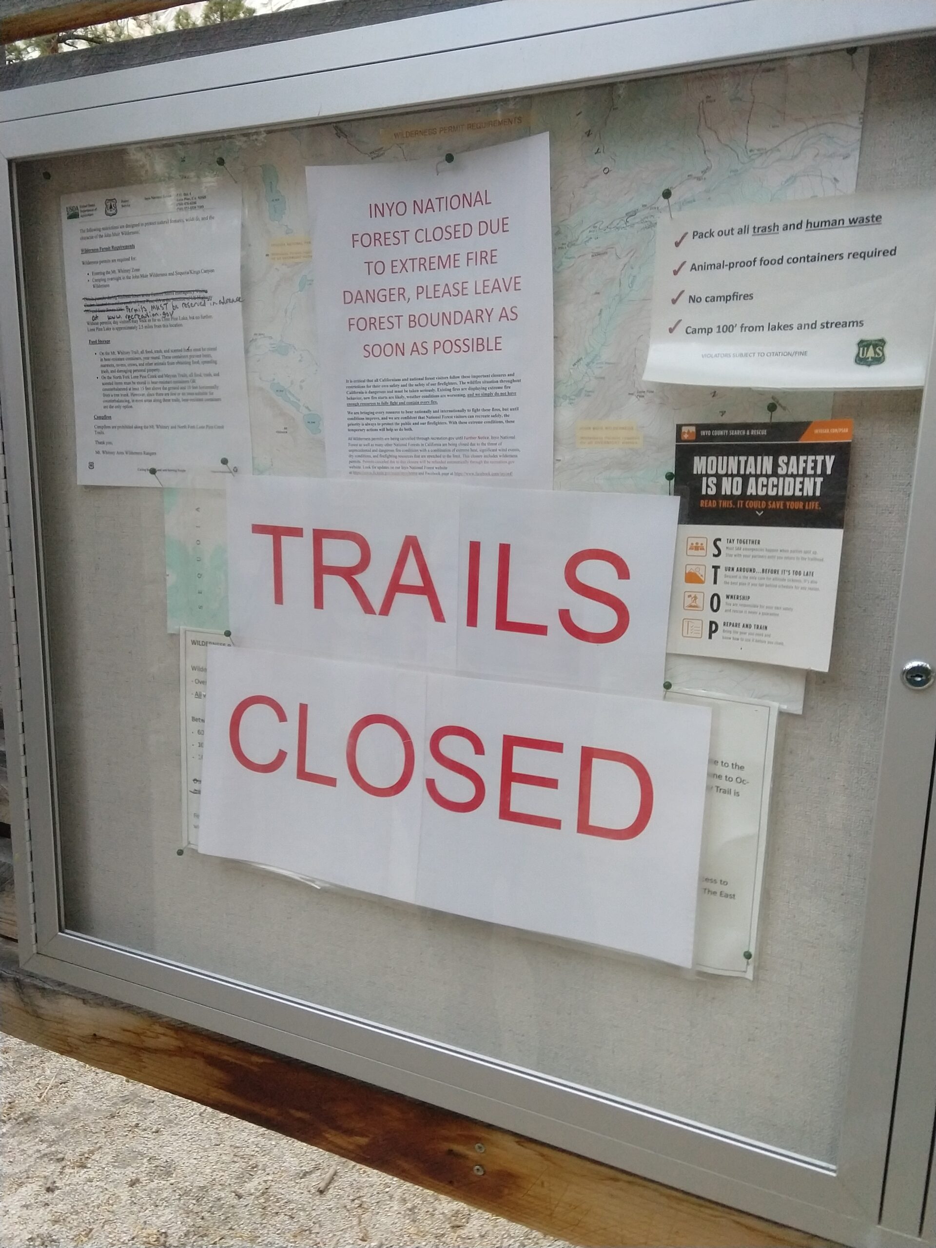
04:56 marks our start time. It’s chilly but comfortable. We pick up our WAG bags, gloss over the outdated and yet to be removed “TRAIL CLOSED” sign and start up the trail. Headlights leading the way. Half an hour in we see another vehicle in the parking lot and we have a tail. Half an hour later and we’ve lost them. Concerning :/

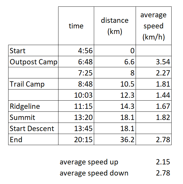
To track our pace, and make sure we’d get up and down the mountain safely, I marked down whenever we took a break and how far we’d gone. I was somewhat successful with this on the way up. And on the way down had other things on my mind. Summary at the end of this post.

06:21 we enter the Whitney Zone, 06:48 we hit Outpost Camp. and at 07:25 we’ve done 8.0km of our 18km ascent (then there’s another 18km down). We’re feeling pretty good. We’ve climbed 800m of the planned 2000m.

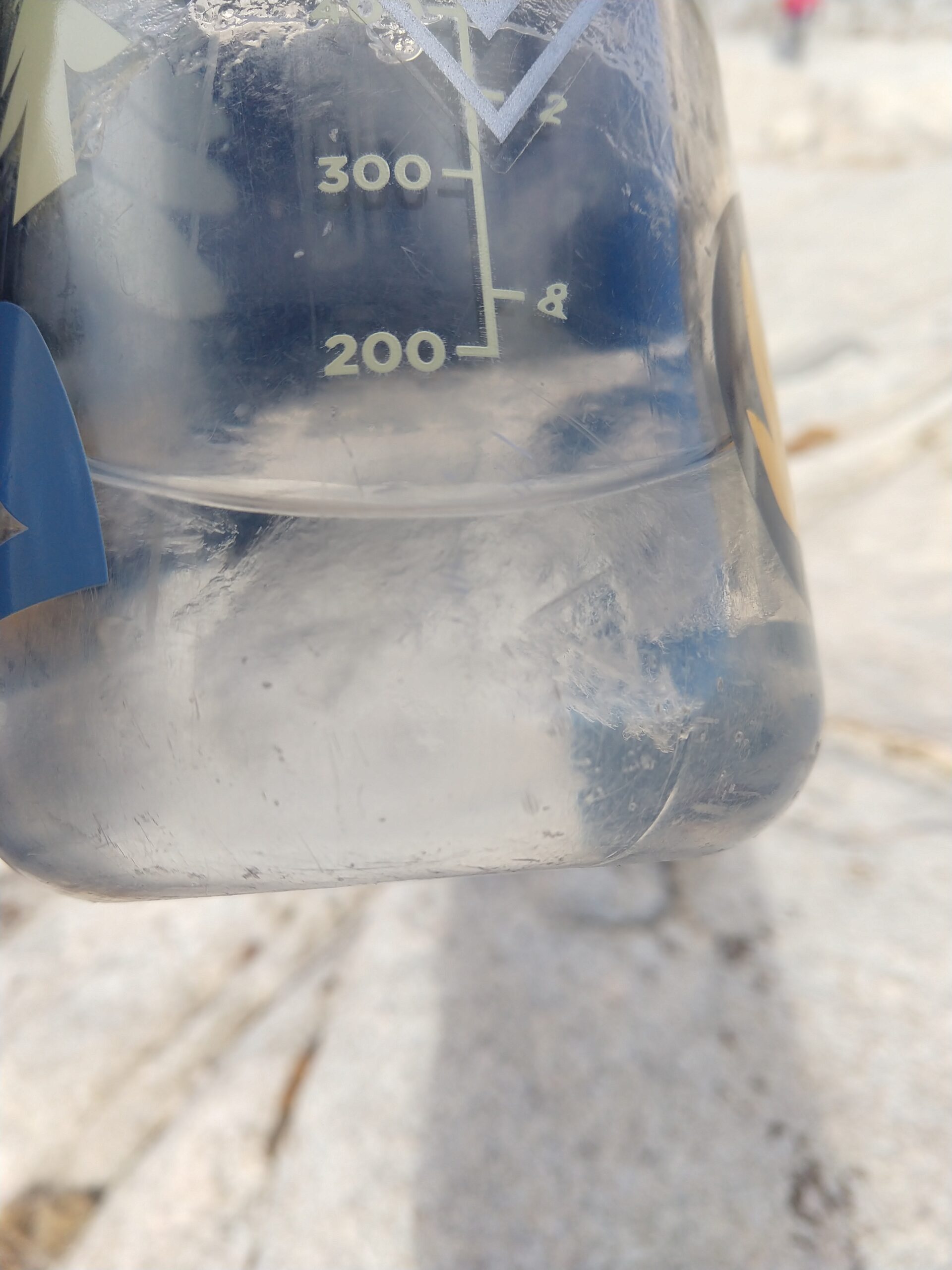
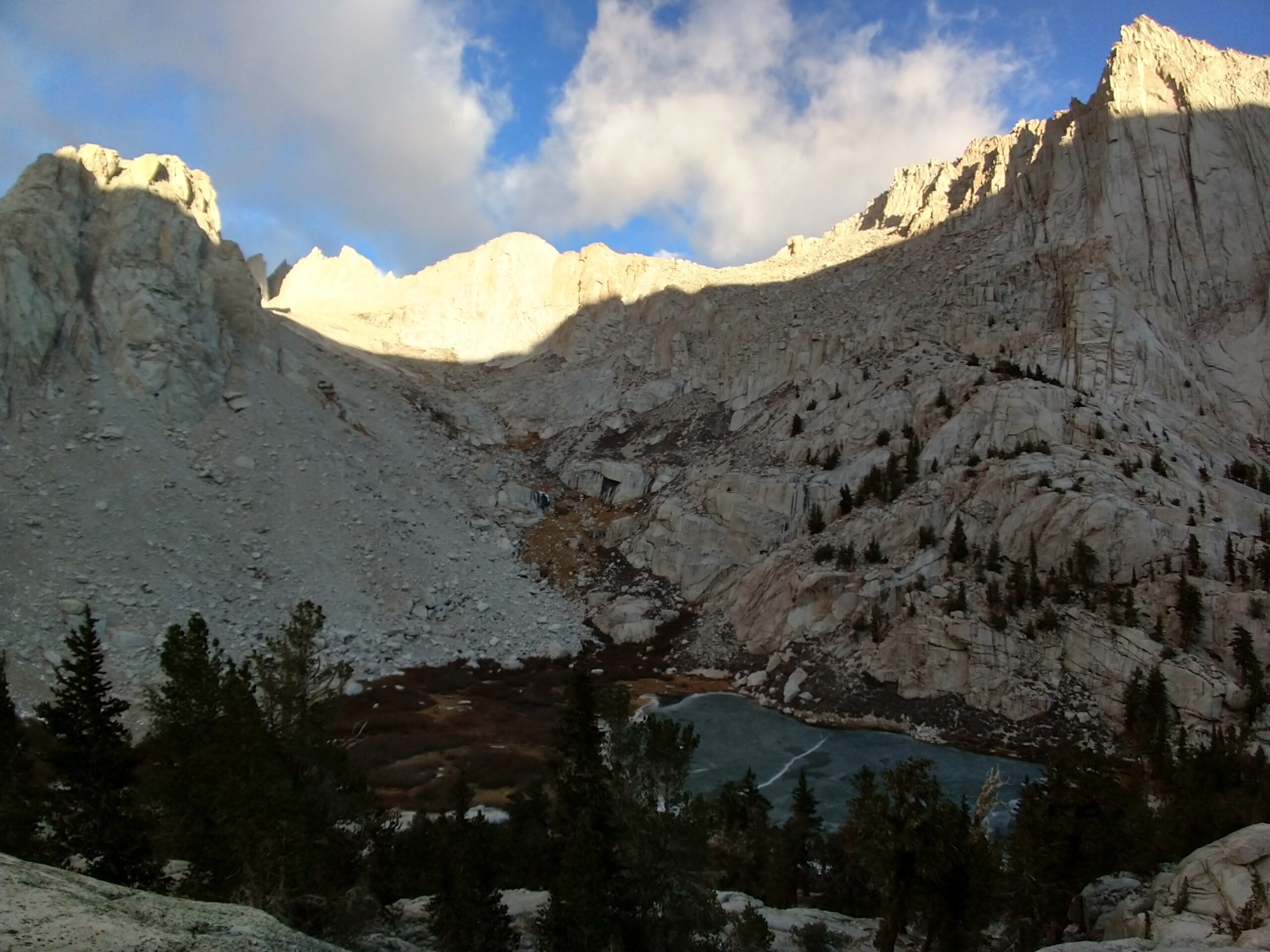
It’s cold, earlier thoughts of removing base layers disappeared quickly as we ventured deeper into the valleys, and gained altitude. Running streams with hints of cold temperatures are followed by completely frozen lakes, and rock hopping surrounded by ice. But we’re prepared. Gloves stay on. Bandanas and masks that had previously been intended to limit covid transmissibility now do double duty keeping our faces warm. Ice starts to form within our water bottles.

Ice crystals forming

08:48 the sun is well up, but not hitting us. Headlamps are long since forgotten. We just arrived at Trail Camp. It’s empty. We met a couple making their way down half an hour earlier. They’d spent the night at Trail Camp. I do not envy them. Having survived the frigid night, and inspected conditions, they had elected to not summit, and instead head back down to the warmth. What do they know that we don’t?

It starts to snow on us. It’s very weird. The sky is mostly blue with some puffs of cloud. But those puffs of clouds are blessing us with the lightest snow I’ve ever experienced. Weather forecasts predicted clear conditions, and besides these wisps of clouds, the sky is otherwise barren. We forge on. We have switchbacks awaiting us.

It’s an itty bitty snowflake! Look at it!

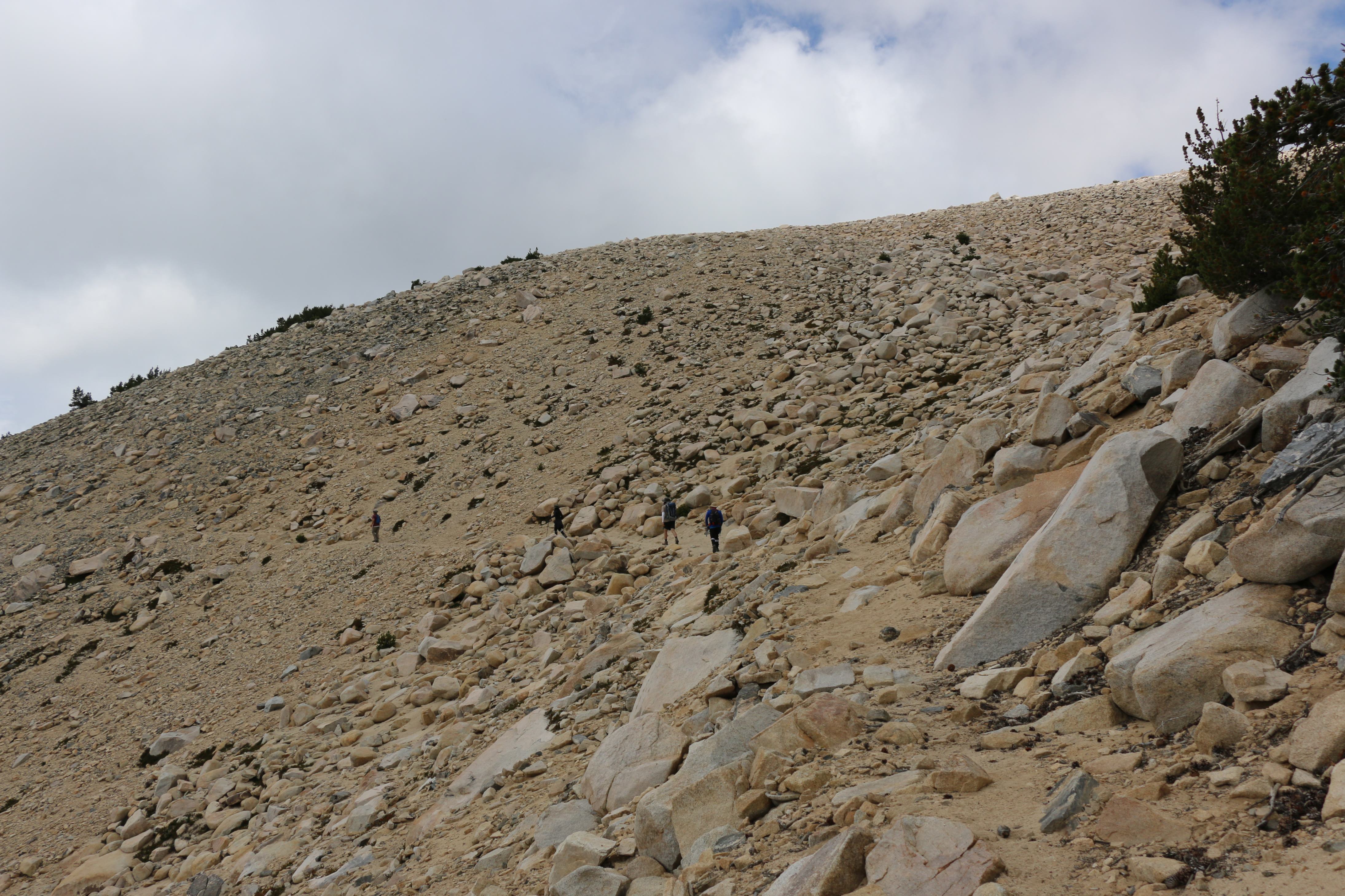
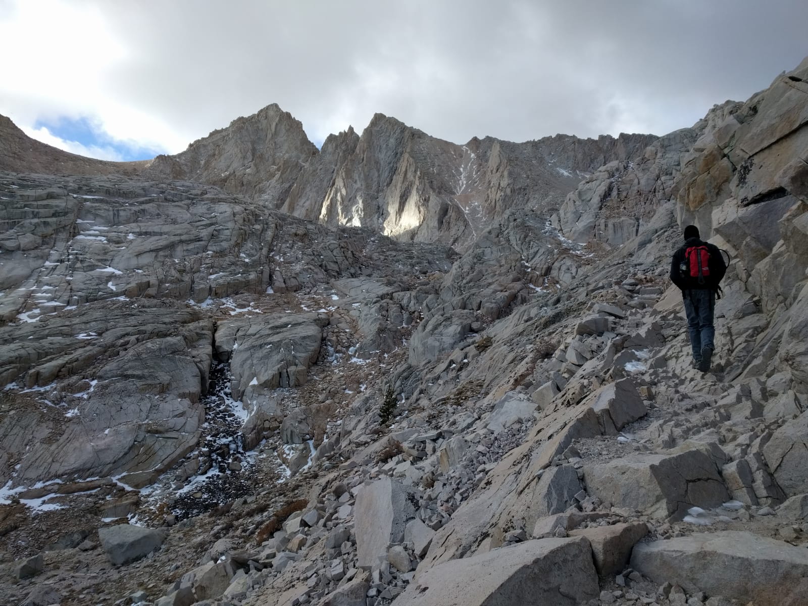
We break at 10:03 (12.3km). There are a lot of switchbacks. The gradient is extremely steady, and very manageable, but it’s a long way up. A few snowy sections demand caution, but nothing overly dangerous.

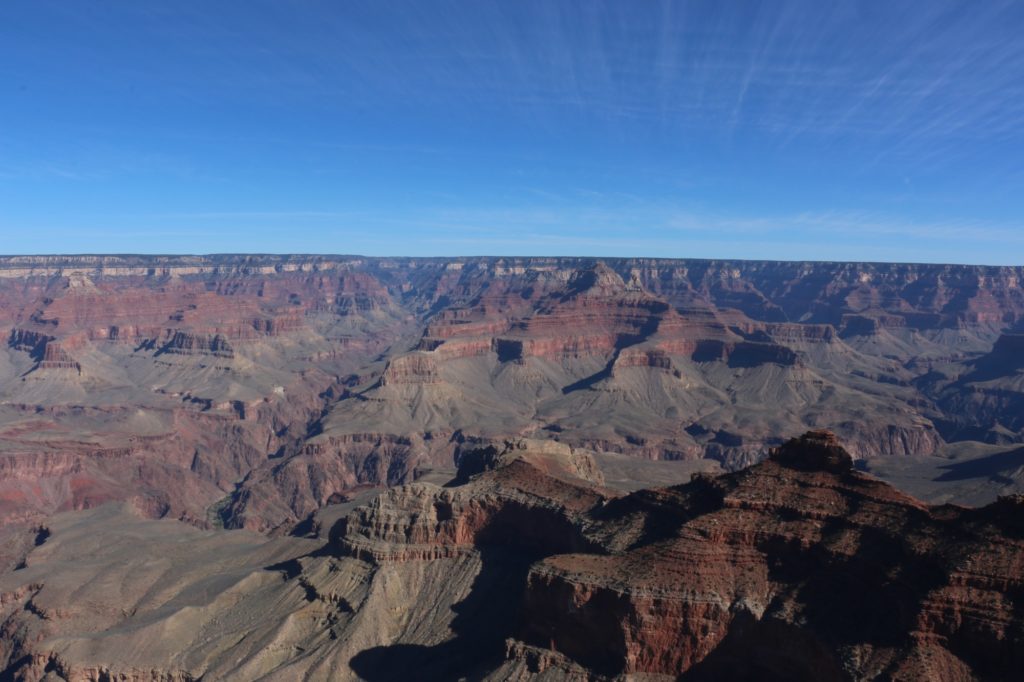
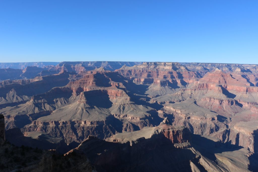
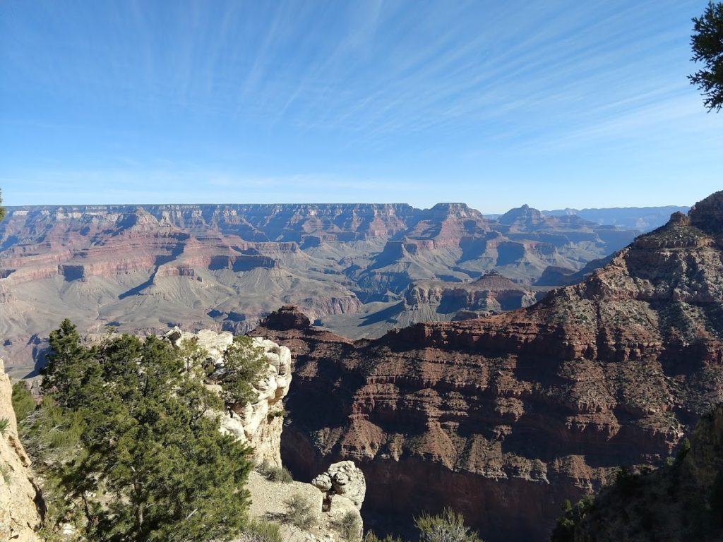
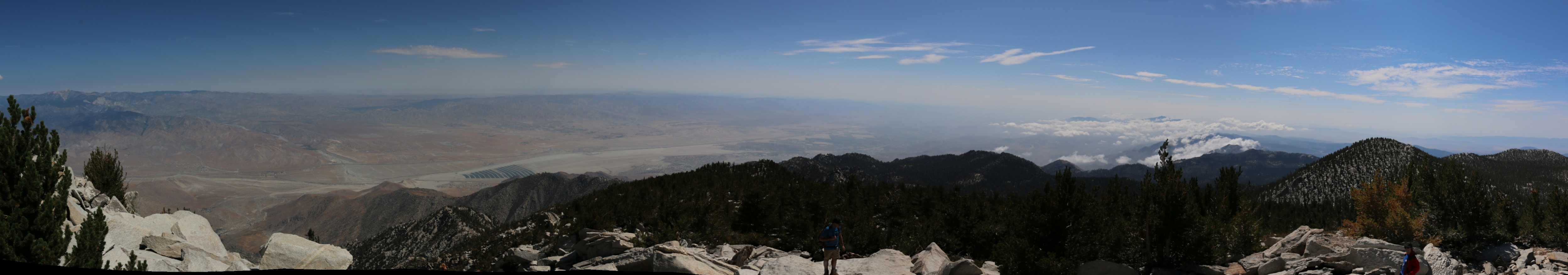
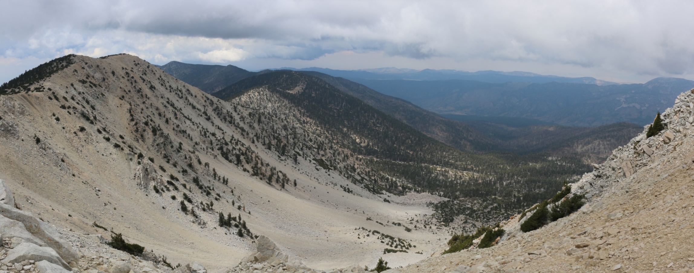
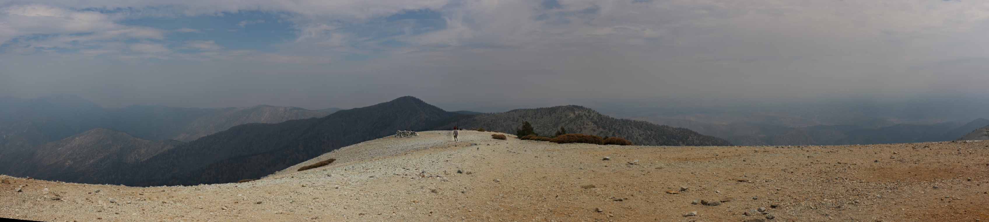
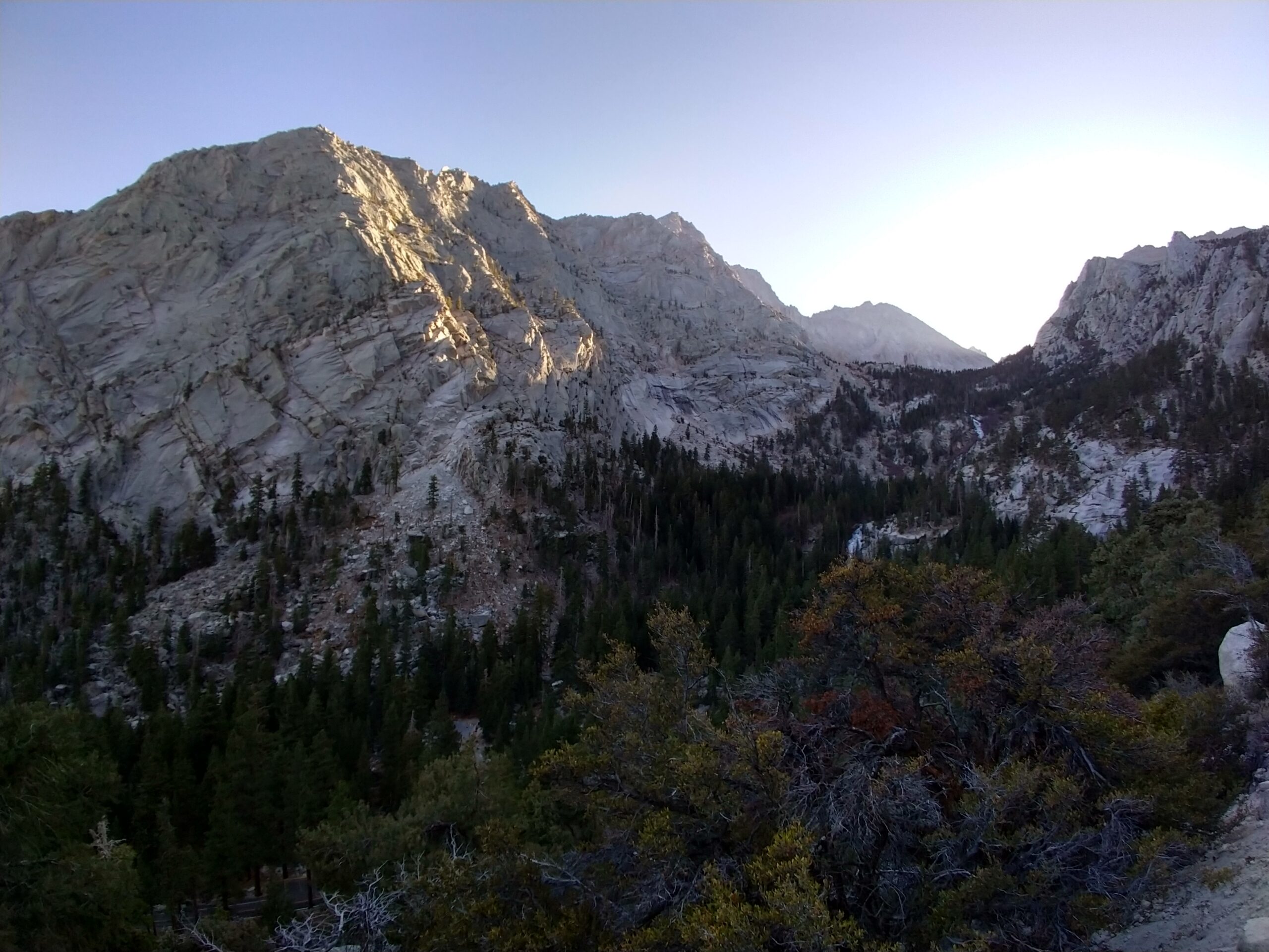
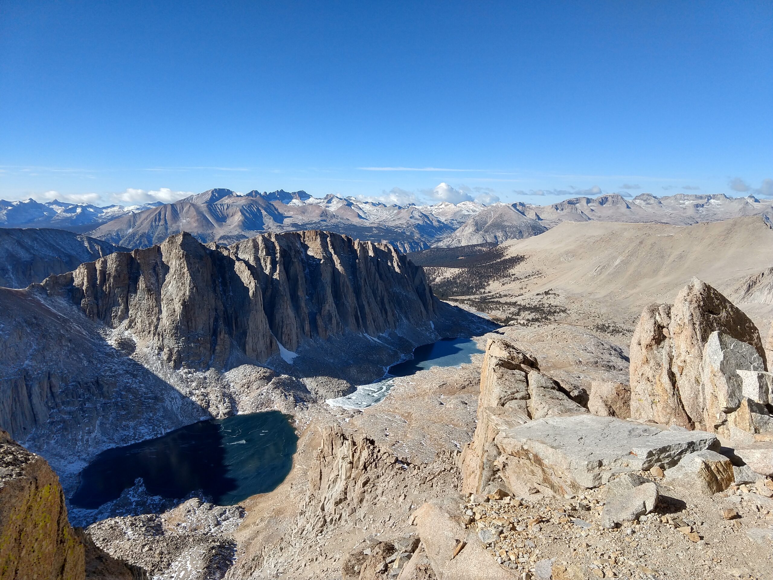
At 11:15 we crest the ridge that divides Inyo National Forest from Sequoia National Park. The views down into Sequoia are astonishing. The landscape is incredibly barren, spotted with trees and the most amazing looking frozen lakes. We’ve done 14.3km. We’re at roughly 4200m. Only 5km left, and another 250m of altitude to gain, unfortunately first we have to drop down 100m.

As we’re getting ready to go a guy comes down. He was our tail from 6 hours ago. He’d done the mountaineers route. Enjoyed his time at the top and was on his way down. We’re jealous he made it to the top so fast. It would be nice to be heading down now.

View from the Ridgeline, looking down into Sequoia National Park

We’re both feeling pretty good at this stage. It’s taken us a long time to get here. But we’re not terribly behind schedule. We catch some sunlight here. It’s glorious. Weather forecasts predicted -20 C at the summit. I’ve experienced those temperatures for brief times while skiing, usually followed by some good time in front of the fire. There is no fire here. Even were it to be allowed, there is nothing to burn.

The biggest issue we’ve faced thus far is a slightly upset stomach, a headache, and our camelback nozzles freezing. Not the end of the world. But what do you do when your water freezes. Fortunately the liquid in our packs themselves remained mostly unfrozen. Somehow. Besides our times in the sun, I don’t think we’ve experienced temperatures above freezing the entire day.

But we could keep ourselves warm. Unfortunately we couldn’t control the altitude (I mean we could, but we wanted to get to the top…), and this is when it started to take its toll. The last 2 hours of hiking was some of the least pleasant time I’ve ever experienced. Fatigue. It just killed me.

It doesn’t look cold, but it was

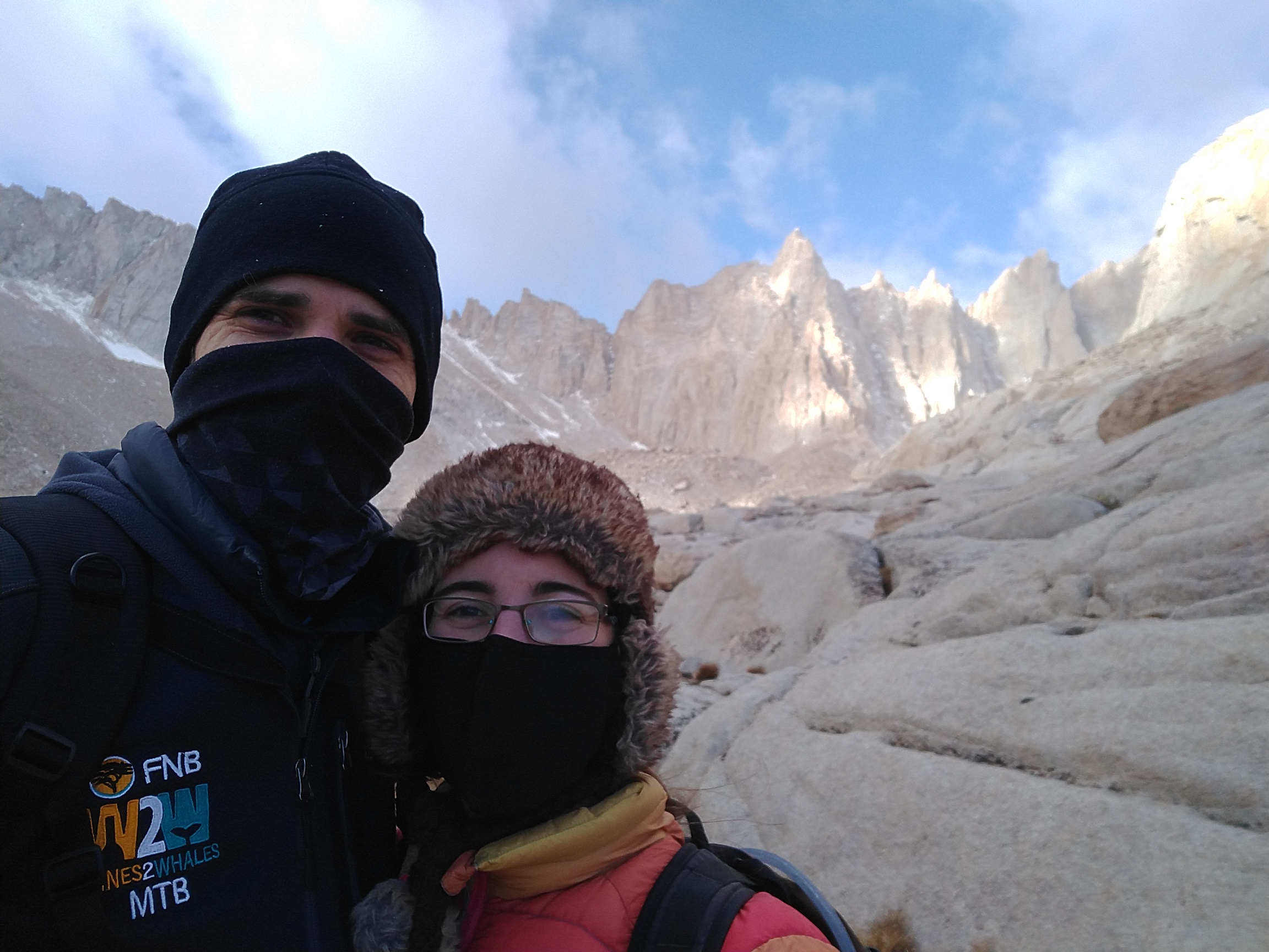
I’ve climbed all the SoCal peaks, but they top out at 3,500m. That’s higher than the highest point in South Africa. For most of my childhood I never spent any time above 2,000m. With only two occasions that I’m aware of to hit 2,900m at the top of the Sani Pass. The highest I’ve ever been outside of an airplane is in the Rocky Mountains, where we got to 3,650m, and we drove to 3,550m, and had a light walk to the top. Now we’re trying to get to 4,400m, and my body is not playing ball.

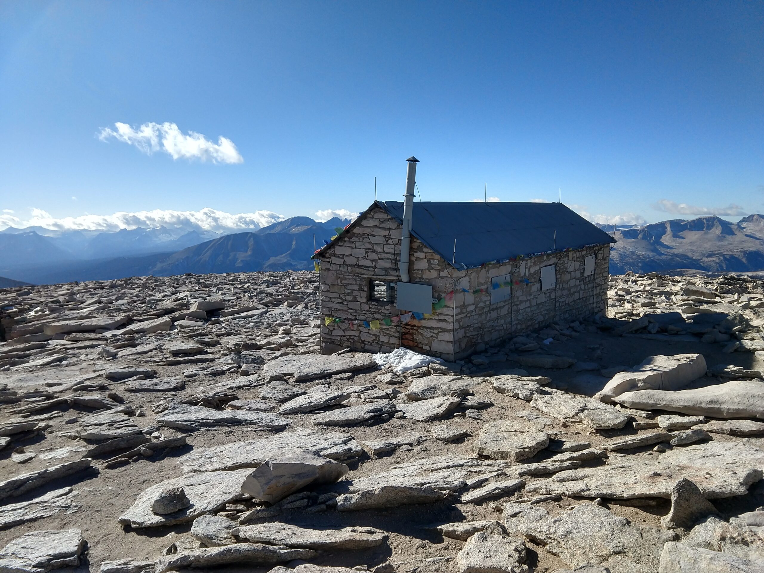
But we’ve come this far. The weather is good, we’ve got food, we push on. The last two hours are gruelling. And the final few hundred meters have you making your way up a convex crest, never quite sure where the top is. We walk a short way, stop, catch our breaths, continue. We see the hut on the top. I’m too tired to be happy. We sit down in the hut. Relieved more than anything else. We’ve made it.

The sign inside the hut says that the hut will not provide protection from lightning

We force down some food. Drink some water, try to recover. But we’re just so tired. I wish I had felt better. I wish I’d given myself more time to train. I wish we’d spent more nights at altitude before trying to go straight up in one day. I wish for many things. We take some photos. We don’t look happy. I didn’t enjoy the top. I have some photos. The views look amazing. But I was in no state to appreciate it. I want to go back.

We spend only a short time at the top. We still have a long day/night ahead of us. It’s 13:30. We should make it down the sketchiest sections to Trail Camp long before it gets dark. Things to be grateful for. We start the descent.

Happy or pained?

Altitude is one hell of a drug. Going downhill is so much easier. Why couldn’t it all be downhill. We still have a long way to go. But at least I’m not having to stop every few minutes. I’m actually slightly hungry. I’m happy to be enjoying food as opposed to force feeding myself.

We’re down the switchbacks. Tarryn counted them. She got 98. It’s easy to see how someone could count differently. I mean, what really is a switchback. Short breaks to eat and drink, but we’re feeling much better. Struggling to remember how terrible we felt just hours before.

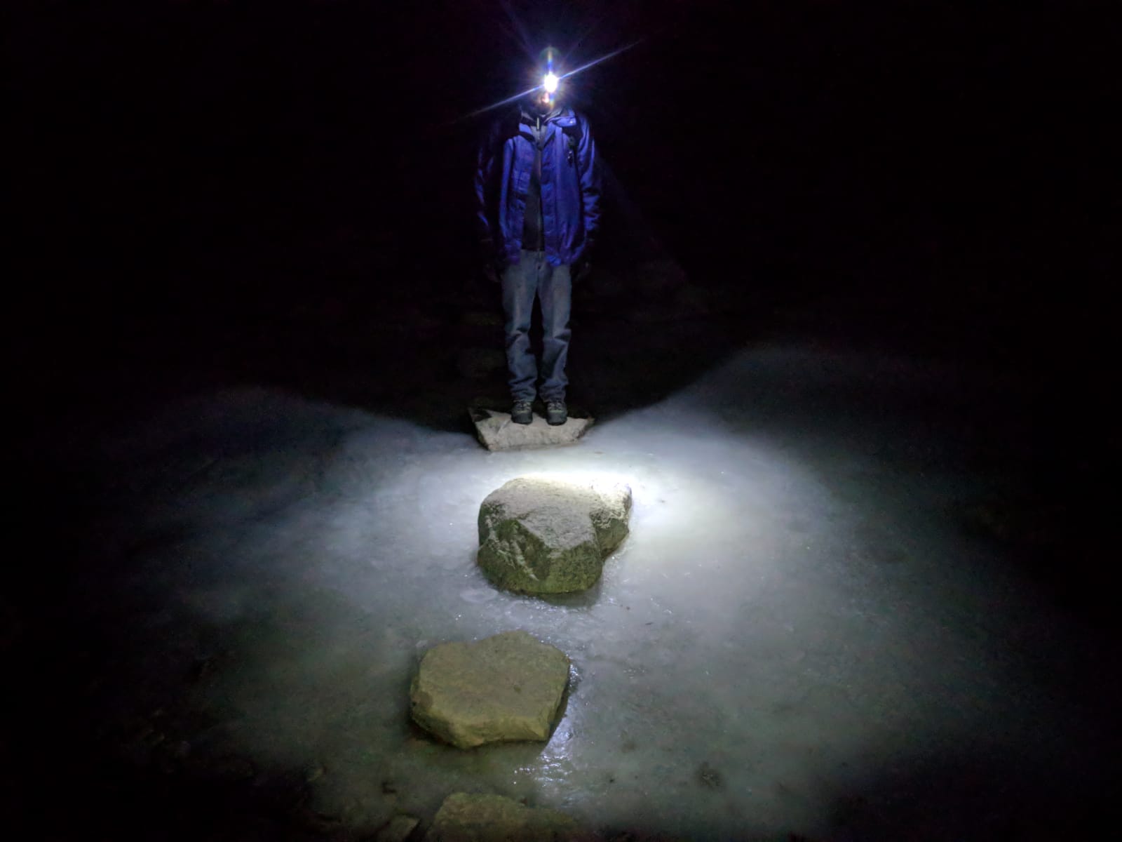
It gets dark and the headlamps are back on. We feel good, but this seems to be taking forever. This path is surprisingly easy to follow in the dark. Like astoundingly. Have to stop once or twice to make sure where the path goes next, but for the most part, just walk and follow the path. I’ve been on countless routes that are harder to follow in the middle of the day.

Surrounded by ice

How is this taking so long? Oh that’s right, it’s just really far.

Ooh someone is following us again. Headlamps are great for being able to spot a tail. The stranger’s light disappears as we go through a wooded section. Stop for another break and zoom! A runner comes flying by. His bright headlamp shining everywhere. Where did he come from? We can’t figure this out. Maybe he did the mountaineers route? He didn’t look kitted out for it, but where else would he have come from? We should have seen him earlier in the day. He checks we’re okay, but doesn’t stop, so there’s no chance to ask.

Rocks

Finally. Finally. Finally, we make the final turn dropping the last few meters to level up with the parking lot. We’re so close. It’s 20:15. It’s been over 15 hours since we left our car here. The “TRAIL CLOSED” sign is down. That’s reassuring. We hop in our car, eat a snack or two and make our way back to our campsite.

At the campsite, I walk to the restroom. I don’t remember this road being an uphill yesterday. Weird. We sleep well. Wake up the next morning and are relieved to be in relatively good condition.

Looking back on it, I’m very glad we took this opportunity to climb Mt. Whitney. Were conditions perfect? No, far from it. It was very cold, we didn’t have the time to prepare and acclimatize like I would have liked. Would I suggest other people do the same thing? Probably not. Often for hikes like these, you’re advised to just come back later. The mountain’s not going anyway. And it’s true. Whitney’s not going anywhere, but sadly we are. We’re most likely not going to have another opportunity to climb Whitney. So I’m glad we took it.

there’s just something about frozen lakes I’ll never get over

For everyone else though, you want to do it earlier in the year. It was at times unpleasantly cold. You want to take time to acclimatize. You don’t want to feel like I did on the summit. I was miserable, I didn’t appreciate it, I couldn’t. Camp at Whitney Portal a night or two before your hike. Hike to Trail Camp and spend a night there. Take your time and enjoy it.

I’ve added a table below with our average speed for different sections of the route. Besides the first section they’re all much slower than I feel I’ve ever hiked before. They obviously also include break times, so are slower than are actual moving averages, but still.

Grand Arizona

For every day that we spend in the US, we add another location to our list of places we want to visit. As such, it’s nice to every now and then actually tick something off the list.

Earlier this month we were able to welcome my parents to the US for a short vacation. We used this as an excuse to do a trip out to the Grand Canyon, and see just a few of the many sights Arizona has to offer.

Grand Canyon National Park

The Grand Canyon is a well-known international destination, and for good reason. Growing up in South Africa I had the opportunity to visit Namibia, and hike through the Fish River Canyon. With majestic views and beautiful scenery, it’s a sight to behold. But as the saying going, everything’s bigger in America.

We’ll skip around the confusing definition of what a canyon is, versus a gorge, or valley, or kloof, or poort, or the many other words with similar but different meanings, and just accept that the Grand Canyon is much larger than the Fish River Canyon, but by no means the largest in the world, or even the Americas.

Stretching almost 540 km, the canyon reaches depths of almost 2 km, with rims as far apart as 30 km. It is truly grand to behold. The most common place to visit is the South Rim of the Grand Canyon National Park. And this is where we ended up. November is considerably cooler than the Summer months, and although snow is always a risk, we were blessed with very mild conditions. The cold weather does ensure far fewer visitors to the park compared to the summer months.

From LA it’s a pretty easy 8 hour drive to the Grand Canyon. There are different routes you can take, but not a lot to be seen if you’re trying to do a one day trip. Above you can see our full route for the trip. Green marks a place we overnighted, yellow marks a POI we stopped at and blue is the route we drove on a particular day.

We spent two two full days exploring the Grand Canyon National Park (three nights), opting to stay at an AirBnB just out side the park instead of the variety of hotels within the Park. Camping is on the list for next time, but wasn’t feasible with overseas guests. Instead we got a spacious, woodfire heated cabin, miles away from anyone, all to ourselves.

Two days is certainly not enough time to see everything in the park (and we were only looking at the South Rim), but we tried to see as much as we could. Day 1 we just spent getting our bearings. Hiking out to Yaki point in the East, returning via shuttle for lunch, and doing a combination of hiking and taking shuttles along the rim path to Pima Point in the West. Getting to take in all the splendour of the canyon, spending plenty of time stopping for photos.

Bright Angel Trailhead, Grand Canyon National Park

For day 2, we really wanted to get into the canyon a bit. The easiest way to do this is the Bright Angel Trail. Starting in the Grand Canyon Village, the trail drops down past two rest stations and onto a small plateau. From there it carries on through the Indian Garden where it splits. One route takes you further to Phantom Ranch (on the north side of the Colorado River), and the other to Plateau Point ( a viewpoint into the canyon).

The National Parks Service (NPS) have to deal with hundreds of thousands of visitors coming to the park every year. All of them wanting to see the canyon. Many of them of questionable fitness. Unlike most hiking trails which make you do all the hard work first (climbing the mountain) and give you an easy route back, hiking into the canyon is the opposite of this. As the signs regularly warn you, “Down is Optional, Up is Mandatory”. Additionally many of these people arrive in the heat of summer.

Grand Canyon National Park

This has resulted in the NPS posting very conservative times for completion of hiking routes. We got down to the Indian Garden in pretty good time, but had no idea how long it would take us to get back. Taking the NPS posted times into consideration, as well as the short winter days, we opted to head back up instead of pushing on to the plateau viewpoint.

In hindsight, we could have easily made it to the rim and back without trouble. The hike back up, although gaining considerable elevation, does so at a steady gradient. Meaning it only took us marginally longer to get out, than it did to get in.

Oh well, now we know for next time. We did at least get a chance to stop by the Yavapai Museum of Geology, which offers spectacular views into the canyon, and good displays explaining how the canyon came to form. Well worth the visit.

Grand Canyon National Park

Our next stop was Page, Arizona. If you’re heading north, you should definitely take the time to drive the Desert Trail along the rim of the canyon out East, instead of just sticking to the main roads through Flagstaff. Beyond the additional viewpoints, you also get to stop at the Desert View Watchtower for even more spectacular views of the canyon and the Colorado River.

Dinosaur Tracks, Tuba City

When travelling between Page and the Grand Canyon South Rim, you can also stop by Moenkopi Dinosaur Tracks. Sitting on a part of the Navajo Nation, this attraction is self-managed, and not part of a National Park. In my opinion this makes for a non-ideal situation. You’re given an amazing first hand experience of multiple dinosaur artifacts, including very clear dinosaur tracks, with the ability to even touch them. However, there is no thought of conservation. And no information is available, besides what a guide may be able to tell you. Entrance is free, but you will be approached by locals offering to guide you, also free of charge. You should take a tour, and tip your guide at the end. Less than half an hour, but amazing to see. You can read more about it here.

Horseshoe Bend, Glen Canyon National Park

Page is a small town that many people probably don’t know about. It started as a company town to house the people building the Glen Canyon Dam, that contains Lake Powell. Many residents now work for the nearby Navajo Power Station.

Lees Ferry, Glen Canyon National Park

Lake Powell is a popular tourist destination for boating enthusiasts, but Page is also well located as a center point between a multitude of National Parks. As for things to do in Page, it’s most notable tourist attraction must be the distinct Antelope and other slot Canyons. Amazing colours, with intricate lighting provides plenty a photo opportunity. The well-known Horseshoe Bend is also only a few minutes drive out of town. We can also recommend a drive out to Lee’s Ferry. It has several great hikes, and access to the Colorado River.

Antelope Canyon, Navajo Nation

With only a week for our trip, we didn’t have time to see much else, but did make sure to drive through Zion National Park. Another location with stunning vistas, immense mountains and natural beauty. We fortunately were able to take the time to stop in the park for lunch and hop on a shuttle up into the deeper parts of the canyon. As with every stop we made on the trip, it was well worth it. Zion is definitely staying on our list of places to visit, deserving more time to hike and explore.

Court of the Patriarchs, Zion National Park

Our trip was scheduled to end in Ventura, visiting some family. To cut our last day in half we set our sites on Las Vegas. Picking a hotel just off the strip we were able get just some of the Vegas experience, without diving in completely. A walk down the strip, dinner and some fountains were a nice way to wind down.

Bellagio Fountains, Las Vegas

One week is by no means long as far as US roadtrips are concerned, but it gave us enough time see what we wanted to see without rushing. The trip added another 1,700 incident free miles to our car, getting it to cross the 90k mile mark somewhere between Vegas and Barstow.

The rest of the year looks to be fairly quiet beyond some local camping, but next year we hope to limit the international travel and instead focus on seeing more of the US. Zion is already on the cards for April.

Three days, three mountains

A local outdoor supplies store puts on the A16 3-Peak Challenge every year. I first heard about it last year, but it was too late in the year to attempt. The challenge is to climb three of the highest peaks in Southern California within a certain self-defined time, either 24 hours, 3 days, 3 weeks, or 3 months. 3 days seemed like an achievable but tough goal, so at the beginning of the year already, my wife and I decided we should attempt it.

The year got busy and we didn’t. Running out of time, we identified the Labour Day long weekend as the perfect opportunity. With only two weeks to spare, we started planning. And realized how late we’d left it. While the peaks are all within viewing range of each other, depending on traffic, it could take us 4+ hours to get to some of the trailheads. It made sense to camp somewhere central for the weekend.

As we’ve come to realize though, Americans are far more active campers than South Africans, that or there are just more of them. Los Angelenos are anyway, as all 250ish of the campsites in the San Bernardino Forrest had already long been reserved. So we decided to chance it, and grab one of the first come, first serve campsites.

The next challenge is that San Gorgonio requires a permit to hike. The popular Vivian Creek Trail’s permits were all issued, for every day of the weekend. After a bit of digging, we found that an alternative route had recently opened, and still had permits available, turnaround time was 5 days though.

And so it was Friday afternoon that we set off to the San Bernardino Forest to camp in a site we didn’t yet have, and climb a mountain we had not yet acquired a permit for. But apparently it was meant to be. We arrived late on Friday evening, and after finding a full South Fork Campsite, we lucked out on an empty spot amongst the Yellow Post Sites.

As part of the challenge you are allowed to choose any order to do them in, and pick any route to the top. We wanted to do Baldy (San Antonio) last, as it was closest to home, and would allow us to go straight home, instead of returning back to camp, this meant it had to be done on Monday. We didn’t arrive early enough on Friday to pick up a permit from the ranger station, so that meant Gorgonio would have to be on Sunday. So our first hike was San Jacinto.

San Jacinto (via Palm Springs Aerial Tram) – 3,300m

SanJacinto

View from the top

We had previously attempted San Jacinto via Marion Mountain. It wasn’t really a planned attempt though; started far too late in the day (11am) and ended in the dark (8pm at the start of winter), without us having summited (me being ill being partially to blame).

The A16 challenge however encourages you to take the Palm Springs Aerial Tramway part (most) of the way. Although making it an easier climb, it still requires some effort. The tramway is something in itself; a cable-car setup identical to Table Mountain, but climbs from 805m all the way up to 2,600m. Cost is roughly $25 per person, and there was a $5 parking fee. This leaves an additional 700m (920m of climbing) to the summit.

San Jacinto Cablecar

There is a large area you can walk around if not intending to summit, but if you intend to enter the wilderness area, a permit is required. Permits are free of charge and can be collected at the ranger’s station at the top of the cable car. It’s a beautiful hike through the pine forests at the top. While fairly short, at only 8.8km, it’s still a tough hike. We were in a bit of a hurry, as we still wanted to get back to Gorgonio to pickup a permit, so pushed through to do 2ish hours to the summit. With a 20min lunch break at the top, it actually took us a bit longer to get back down. Mainly due to waiting to allow later ascenders to pass us by (mountain rules are you yield to those ascending), many of the higher paths only have space for one person at a time.

The weather at the top was cool but sunny, with thunderstorms forecast for the afternoon. It made for easy hiking, and the forest provides a lot of shade during the hike. Just before arriving back at the tram station, you’re forced to endure a short climb up again. This promptly necessitated a stop at the restaurant/cafeteria at the top to grab an ice-cream before our descent.

18.5km, 920m elevation
Tram up departed: 08h43
Summit: 11h15
Tram down arrived: 14h15

San Gorgonio (from South Fork) – 3,506m

SanGorgonio

View near the top

San Gorgonio, also known as Old Greyback, is the highest mountain in Southern California, topping out just over 3,500m. There are three main routes to travel it, but up until recently only the Vivian Creek route has been open. The South Fork and FIsh Creek options having been closed due to fire damage for the past year or two.

Vivian Creek is still the most popular route and results in its permits getting issued quickly. As such we resorted to the South Fork trail. It was conveniently located only a few miles from our campsite, which made a 7am start a bit easier, and you could still receive same day permits if you desired. While Vivian Creek is the shortest route to the top, the South Fork route doesn’t have as much climbing. We hiked up via Dry Lake, and after reaching the summit circled back via the Dollar Lake route.

SanGorgonioScarredThe fire damage has resulted in some truly spectacular scenery on this hike. The route takes you through vastly different landscapes, all very green for this late in the summer. The route has one of the most constant gradients I’ve ever experienced. There are very few extremely steep sections, and at the same time, almost no flat areas. This makes the hike quite a slog, and the hike back down can get very long. Many people prefer to do this route as a multi-day hike.

Not an option for us. We enjoyed being surrounded by various birds all the way along. After dry lake, you reach a first section of short switchbacks, followed by a long stretch to the Fish Creek turn-off. From there you have several sweeping switchbacks which gain you some elevation and take you past the remains of the a C-47 which crashed in the mountains in the 1950s. It’s remarkable how much of it is still left 60+ years later.

OldGreyback

After the switchbacks, it’s still a bit of walk as you swing around behind the mountain, meet up with the Vivian Creek trail and do the last stretch to the summit. From there you’ve got a long walk home. The Dollar Lake route may not have as many switch backs, but it is just as long.

We were once again blessed with ‘good’ weather. It was cool and pleasant on our hike up, but the clouds rolled in as we summited, leaving us with little view. On our way down the rain decided to pay us a visit, and while not terrible, we had to break out the rain jackets, and do some trudging. Would definitely like to give the Vivian Creek trail a try some time to see how it compares.

33.7km, 1,500m elevation
Started: 07h00
Summit: 12h33
Finished: 17h17

San Antonio (via Baldy Bowl) – 3,070m

SanAntonio

View from the top

Mt Baldy should really be done as a round trip, but we’d just spent our entire long weekend hiking, and opted to cut our final day short by heading up and down the same route (something we prefer to avoid), the shorter Baldy Bowl Trail, which passes the Ski Hut.

This being our last hike, we woke up at 05h30, packed up camp and drove halfway across LA, and followed the winding roads up to the ‘base’ of Baldy. As we were driving we were a bit concerned to see a big sign advertising a trail run on Mt Baldy. Things worked out quite well though, as the starting gun went off at 08h00, as we arrived. Giving them a good head-start, as we got our packs ready. In the end they took the longer fire break trails up the mountain, so wouldn’t really have been a problem.

LAInTheDistance

While we both enjoy hiking, it had been a long weekend, and we were a bit over it. The route is far steeper than our previous days’ hikes, even though it was just 3.3 miles. Regardless it was a slog. Along with some confusion as to where the top actually was, we were both slightly surprised to all of a sudden appear on top of the mountain, along with a bunch of runners who had just finished.

I’m sure the views from Baldy can be spectacular, but the normal LA haze had probably been exasperated by the recent fires, meaning our view was not particular amazing. Our hike up had been relatively cool, but as we descended the sun came out in full force, and we were very thankful to have already completed the hard section. The route down had us in much higher spirits, especially with the thoughts of a swimming pool and cold beer awaiting us at home.

10.6km, 1,190m elevation
Started: 08h21
Summit: 11h27
Finished: 13h40

Summary

It was a long 3 days, in which we did little other than hike and drive. By the end of the last day we were tired and ready to get home. That being said it was an awesome experience, and will probably be repeated some time. Each hike has its own unique draw, and (weather permitting) offers some spectacular views from the top.

Having completed it in 3 days, the next obvious step is the 24-hour challenge. While on paper our times would allow us to achieve this, a lot more training would be required to get it right without the luxury of sleep and full meals we ended each day with. Maybe not next year, but someday.

Baseball vs Cricket: the obvious(?) comparison

I don’t necessarily feel that I am the best person to make this comparison. While I feel I know the rules to cricket fairly well, I attended sadly few matches growing up in SA. Resigning most of my spectating to the TV-room couch. At the same time I’ve watched a grand total of one baseball match. Nevertheless I feel it necessary to comment.

It was a fun outing. We watched the LA Dodgers play against the NY Mets at Dodger Stadium. We were fortunate enough to go with friends who were able to answer all our questions, and when they were stumbling, a nearby spectator who overheard our conversation was happy to ensure we did not leave un- or misinformed.DodgerStadiumAt a base level, the sports are the same. You have bowlers/pitchers who try ‘throw’ the ball towards the batter/batsman, who after successfully hitting the ball have to run somewhere. Now there are obviously many differences too. In cricket you only get one ‘strike’, and technically the bowler can have as many ‘balls’ as he wants (no-balls & wides) as opposed to just four, although he’s forfeiting runs each time.

Bowls and pitches all come in different varieties with differing amounts of speed and curve on them. And the man with the bat who’s not receiving is always trying to gain a couple feet (or a lot) before the ball has been thrown. A home run is much like a 6, and even when the ball bounces, they can all still gain two bases in what is known as an automatic double, much like a 4. One complaint I will make is that baseball players apparently need help being told whether they should run or not, as evidence by the first and third base coaches who occasionally wander onto the field.

Like many other things in America, an MLB match isn’t just about the baseball, but the end of every innings instead brings entertainment for the spectators in one form or another. This could be spectators trying to win free tickets, kiss-cams, veteran appreciation or a rendition of ‘Take me out to the ball game‘. It’s understandable that cricket has had to lean towards the 20-over variety, considering the entertainment crammed into a 3 hour MLB match.And I don’t think it’s fair to compare a one-day or test cricket match to baseball. They certainly have different appeals. At around 3 hours, a 20-over cricket match is certainly a fair comparison, although I feel there’s a lot more action involved in such a match than a baseball game. Baseball appeared to have a lot more waiting, especially between batsmen coming out and innings changeover. Something that happens 17 times in a match. Compared to the single innings changeover in cricket, and fairly quick end-of-over switch.

At the end of the day I really enjoyed the game. It was fun learning all the rules and seeing the whole spectacle. My only gripe is the difficulty in distinguishing whether a ball or strike was called immediately after it happened. I feel that everyone on the field obviously knows what’s happening and has reacted, but it takes me a while to catch up. I’m aware the umpire does signal this, maybe our seats were too far away, but in cricket it’s usually immediately evident as to what happened.

If I had to choose between a 20-over cricket match and a baseball game, I’d still go for the cricket match. But in the absence of such events, baseball does a great job of filling the gap. Next up, football vs rugby?

If you’re looking for an alternatively biased article, you can read Zack Case’s American view on how boring cricket is over here.