Camping California

The last few weeks have given us the opportunity to do some camping in and around LA, namely Monte Cristo in the Angeles Forest and a trip to Joshua Tree.joshuatree

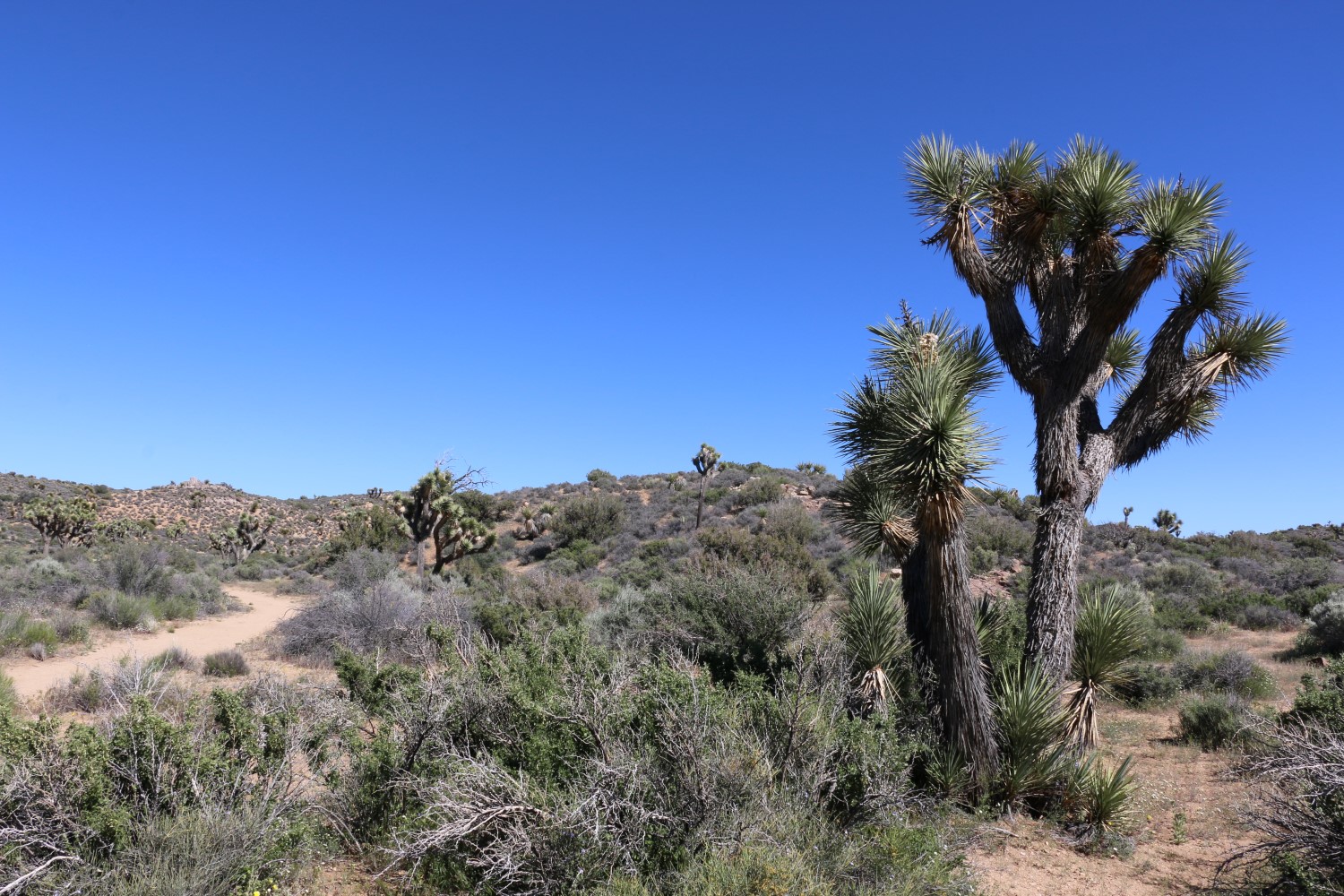
Angeles Forest – Monte Cristo

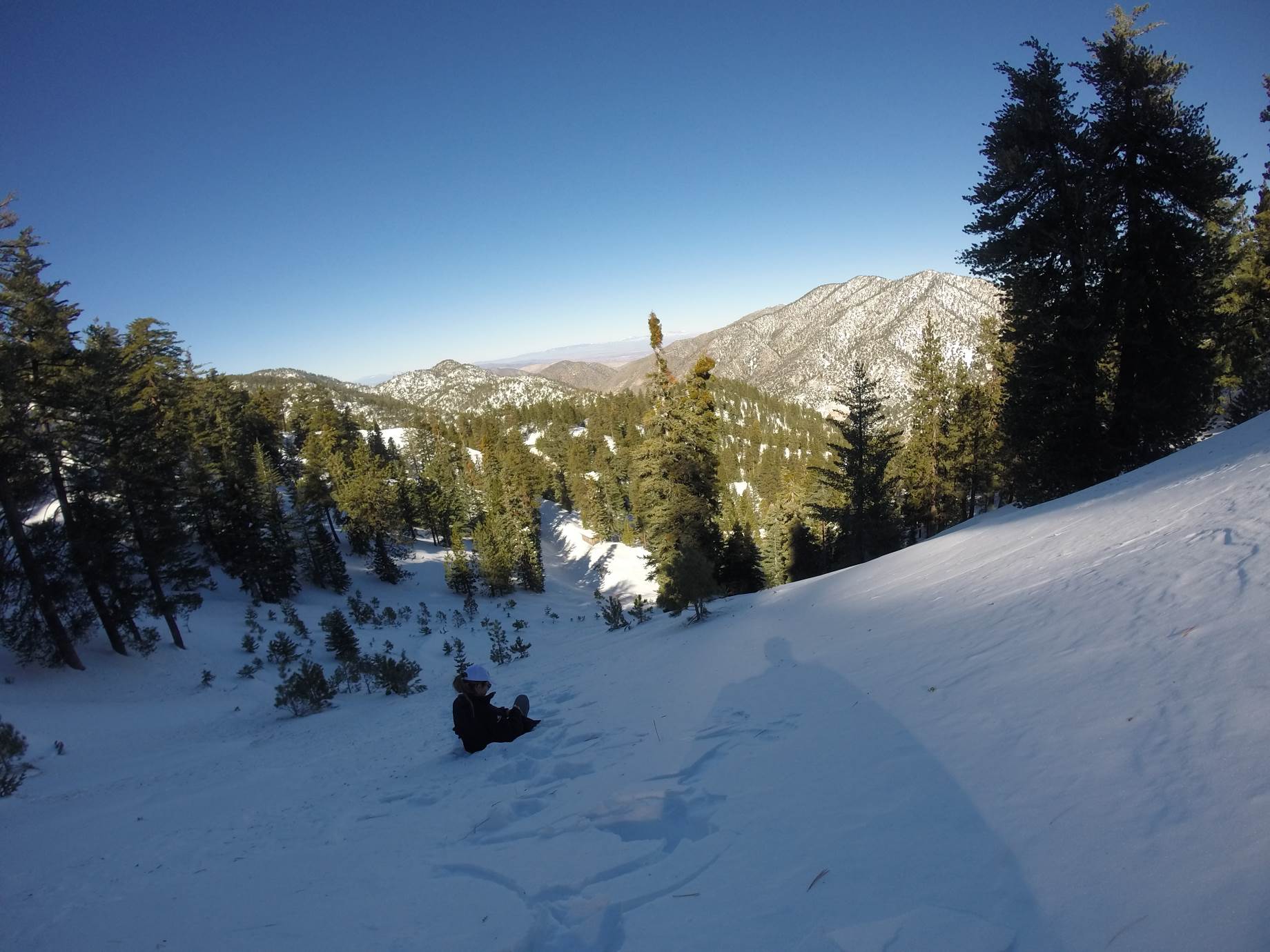
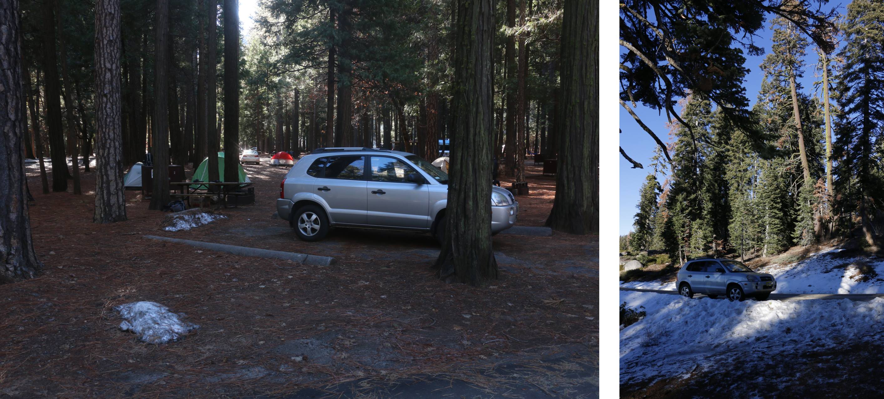
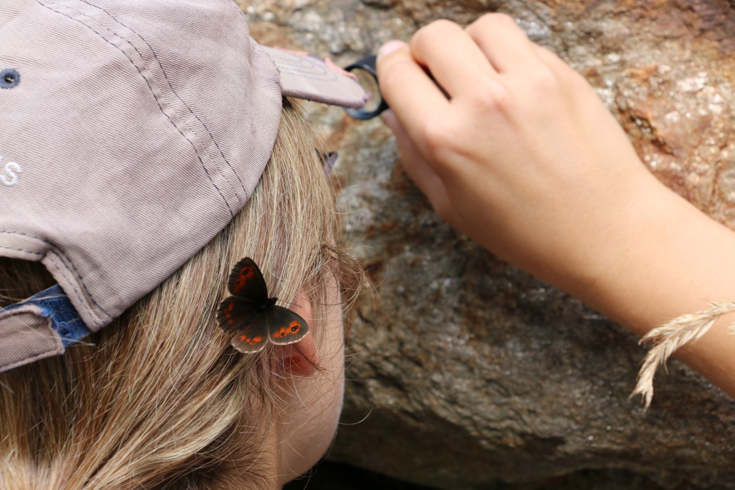
Our first weekend we headed out to the Angeles Forest and spent a night at the Monte Cristo campsite. Campsites are all first come first serve. We got there midday on Saturday and about half the campsites were still available, but by the time sunset came around, the campground was pretty much full.

There’re no rangers at the campsite, so you buy yourself a permit at the entrance, and drop money in the drop-box. There are no ablution facilities besides a couple longdrop toilets which were surprisingly clean. Each site is quite large and has parking for two vehicles. Even though all the sites were full, there’s enough space that you don’t feel people are on top of you. Drinking water taps are shared between adjoining campsites.montecristo
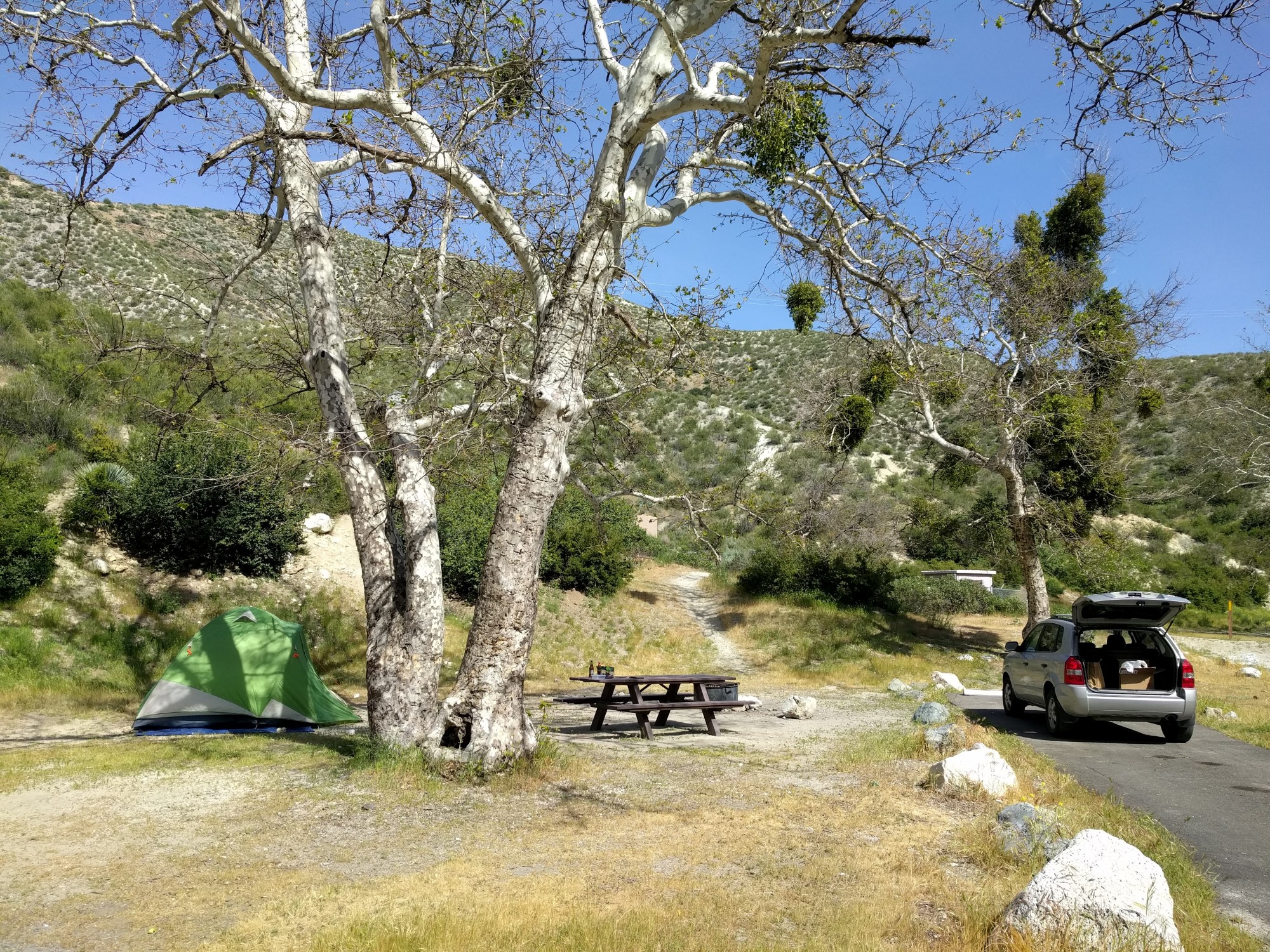
The campsite is nestled nicely in one of the valleys with a river running through it. It is right next to the road, but traffic isn’t that heavy. While the Angeles Forest has plenty of hiking opportunities, none are close enough to the campsite to hike from there. You’ll have to drive to a trailhead before starting a hike.

It was nice to be able to quickly get out of the city and just relax with nothing going on. We didn’t get any cell reception at the campsite itself, adding to the quietness. Angeles Forest has a lot of other campsites which we’re keen to checkout, especially with summer on its way, opening up some of the campsites which were inaccessible during the winter.

Joshua Tree – Joshua Tree Lake

The next week, we headed out early on Friday and drove out to Joshua Tree. Joshua Tree has a mix of reservation and first come, first serve campgrounds. The reservations were full weeks before, and only arriving late on Friday afternoon, we decided to play it safe and camped just outside Joshua Tree at a private campground, Joshua Tree Lake.joshtreelakeThe campsite is quite close to the West Entrance Station of Joshua Tree, which never closes, so you can head into the park whenever it suits you. Joshua Tree Lake has a mixture of campsites and RV spots. The campsites aren’t demarcated, so you just find a spot where there’s space. It wasn’t particularly busy so we chose a spot without anyone nearby. Barrel fires and camping tables are provided, although if it gets very busy, I doubt there’re enough for everyone.

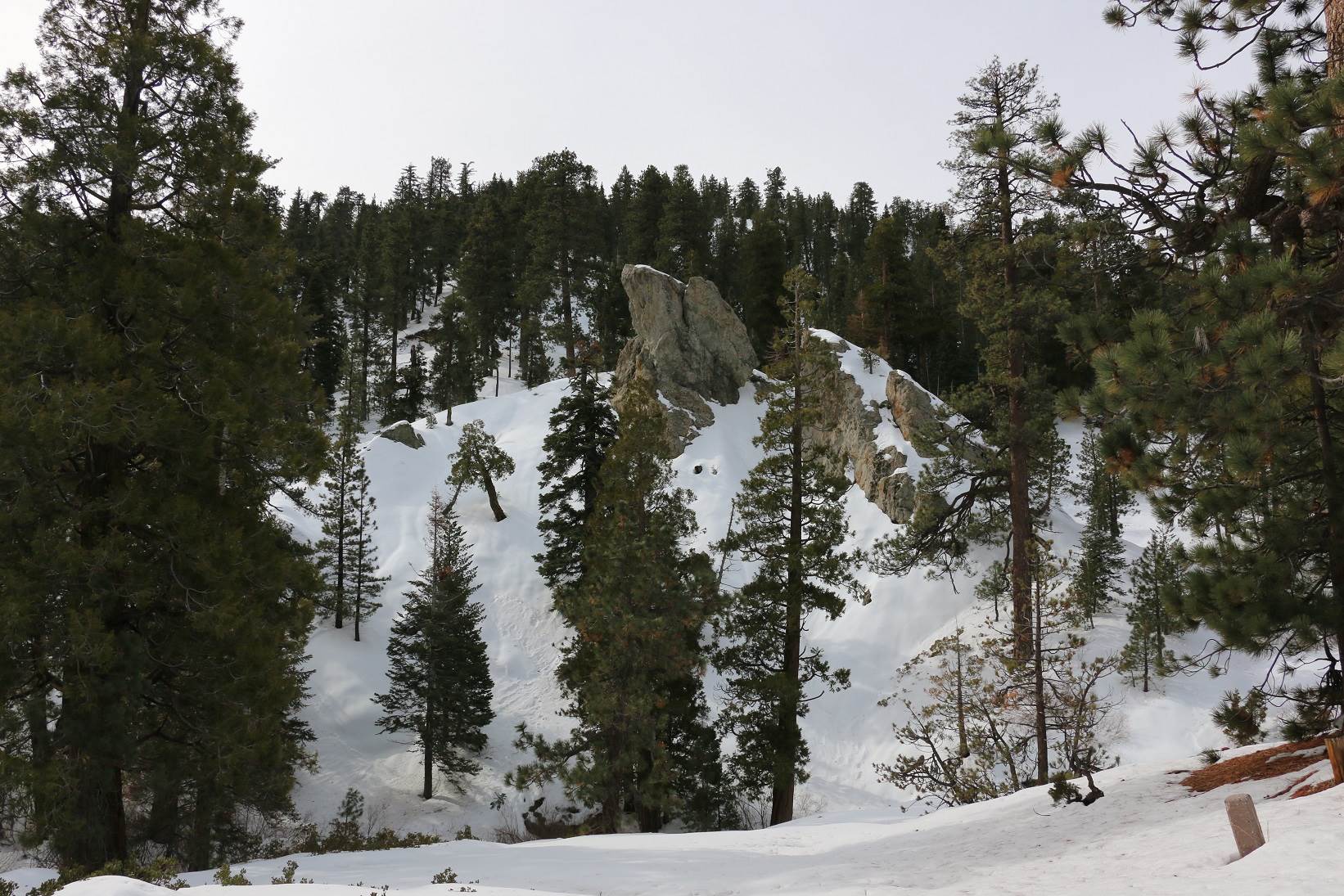
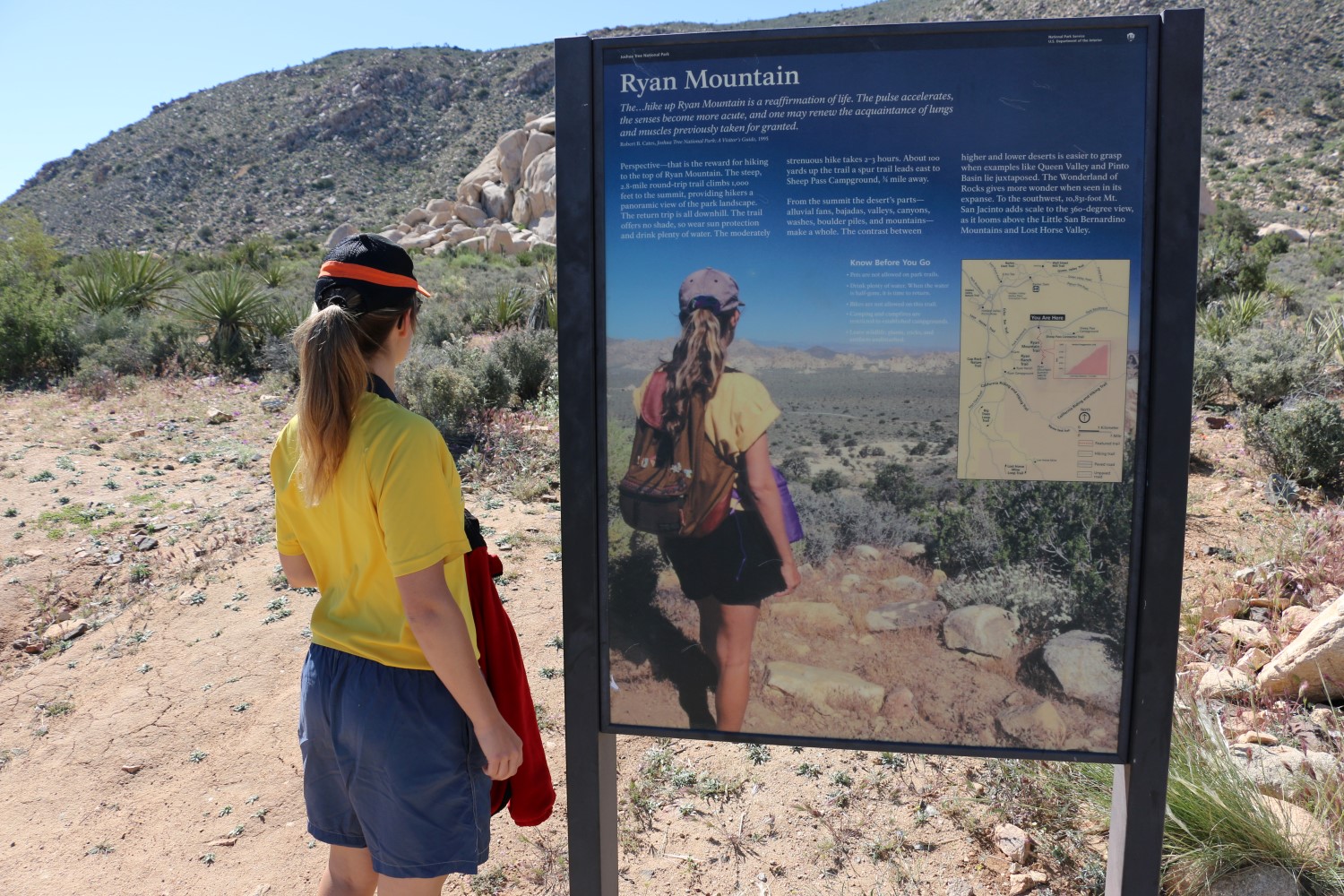
Being in a dessert environment, there’s no grass for camping, but even with a howling wind the whole time, dust was not an issue. Ablutions were clean and showers are also provided.joshtreelakepano
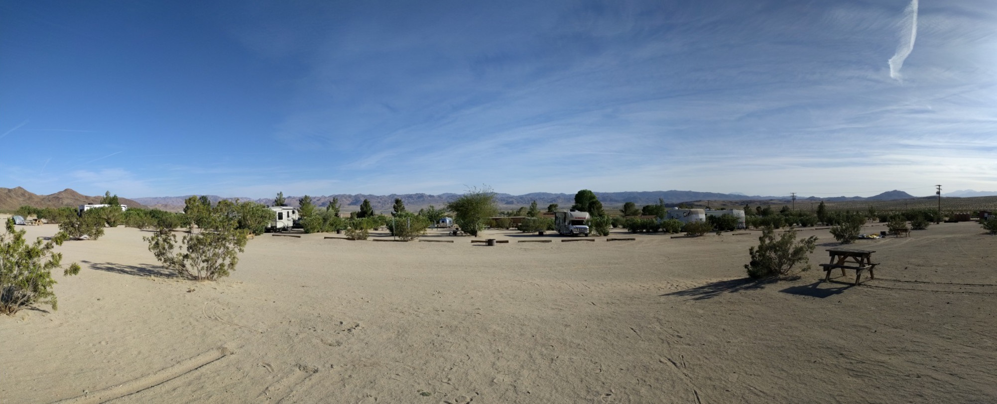
We spent Saturday in the north end of the park, hiking Ryan Mountain and Lost Horse Mine. All the trailheads have limited parking, and in the busy spring, you’re not guaranteed a spot. We were lucky though, arriving early enough at Ryan Mountain that there were open spaces, and getting lucky at Lost Horse Mine that we arrived as another vehicle was leaving.

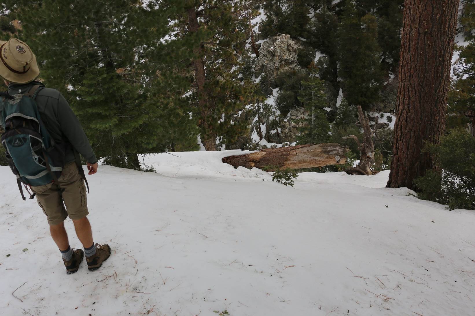
Neither hike was particularly difficult. Ryan Mountain is a straight up, straight back down route that is quite popular and offers good views from a central location. Lost Horse Mine was a flatter and longer loop. It goes past an old gold mine, and some of the buildings still remain there for you to see.

BeforeAndAfter

My wife has apparently been here before.

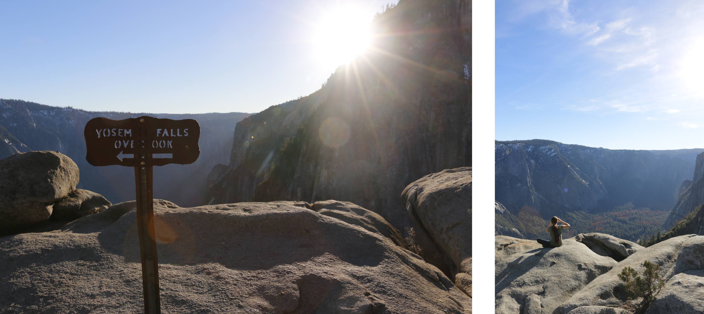
Before heading back to our campsite we decided to drive out to Keys View. It’s well worth it, with spectacular views into the Coachella Valley, spanning as far as the Salton Sea. We considered doing a section of the Geology Tour Road, but it’s marked 4×4 only, and although some of it is supposedly accessible to two wheel drive vehicles, we didn’t feel like risking getting stuck in the sand.

On Sunday we drove all the way through the park towards Cottonwood Springs. It was pretty amazing seeing the vegetation change from the Joshua Tree packed Mojave Desert in the North, to the Colorado Desert in the South. We did a short hike up to Mastodon Peak, which again offered good views.
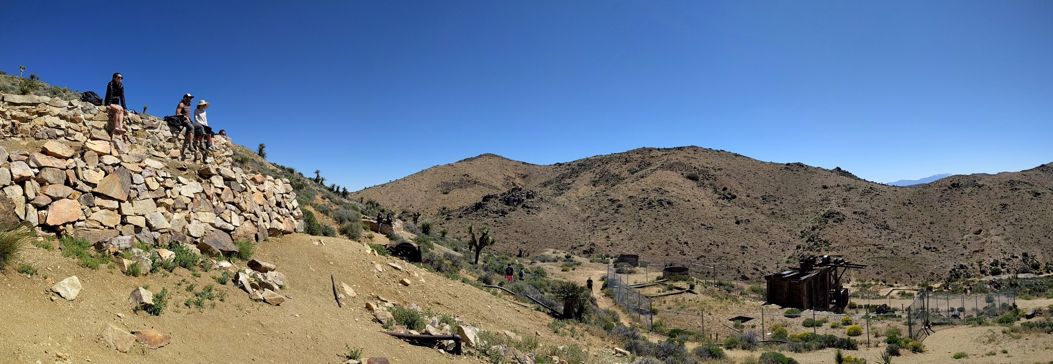
losthorsemine

Lost Horse Mine

While we knew Joshua Tree was popular, we didn’t have major expectations, which resulted in an amazing trip. I don’t know if it was just the recent rains, but the park offers stunning scenery with many hikes and other points of interest to keep you busy. We stopped off at Hidden Valley to watch some of the rock climbers do their thing too at some of the world famous routes too.

California has camp grounds everywhere you look, so we’re looking forward to doing some more exploring in the future.


Angeles Snow

Apparently it snowed in LA in the early 1900s. I’m not so sure about that, but that’s what I’m told. However it definitely doesn’t snow in LA now. We have been blessed with a large amount of rain though in the last month, and LA has several 3,000m+ peaks surrounding it. This means that it does snow in the mountains around LA, and many people have completed the challenge of spending some time at the nearby ski slopes in the morning, and heading back to LA for a swim in the afternoon (it was 25degC last week, mid-winter).Angeles ForestSo last weekend we took a shortish drive out into the mountains to go play in some snow. The nearby Angeles National Forest has a highway going straight through it, so we packed in our snow chains and hiking boots and headed out. Within an hour we had snow around us, and shortly further down the road, a snow plough blocked our path. Apparently it’s too much work to plough whole highway.

We pulled off nearby in any case and climbed up a nearby hill through 3 feet of snow and played around a bit. A week later we decide to head out again and try find the Cooper Falls, also in the Angeles National Forest. A week later, even without any further storms, the snow was still holding out, and our entire hike took place on top of snow.Buckhart TrailThis was a lot of fun. While the city was covered in cloud, as we drove out of town we came out above the snow. We took the Buckhart Trail to Cooper Canyon Falls, and after a bit of wondering we realized the start was from the camp site and not the day site. The campsite is closed during winter, as is the road leading to it, so it adds another mile each way to get to the actual start and end of the hike.Buckhart TrailAll in all we did about 6.5 miles with 3,000ft of elevation, with our highest point around 6,300ft. The route is basically invisible with snow on it. The only way we were able to do this hike is because others had trodden the path before us. There are occasional signs, but if you haven’t done it before, and don’t have a GPS route to follow, definitely don’t do this after a fresh snow. You can see my tracking here.The route was pretty moderate. Some sections were a little scary, having to kick your shoes into the snow for grip on fairly steep hills. Not for someone who’s scared of heights. If you had snow shoes, those would definitely have helped. We saw about 4 other people on the route. But for the most of the time, our group of three was alone.We had a lot of fun exploring the Angeles forest a bit. now that we have a car and know about how many routes the forest holds, we’ll definitely be back for some more, maybe in the summer.

Cooper Canyon Falls

A permit is required to park anywhere in the park. Day permits were available at the Clear Creek Info Centre on the way in for $5 (cash only), but NPS permits are also valid.

Holidays! San Fran, Yosemite and Sequoia

It’s the end of the year, and although I don’t have holidays per se, I took a break to have some fun while my wife is on holiday. Her and a friend attended a conference in San Francisco, so at the end of the week I joined up to form our touring group of four. With a new set of second-hand wheels, our trip was planned and ready to go.

San Francisco Bay, with Alcatraz in the background

I took the PCH1 all the way up from LA to San Fran to meet them there. I overnighted in Monterey at the HI hostel located near the aquarium. It was a beautiful drive, although it rained the entire way, including a few manoeuvres to dodge the fallen rocks. Definitely on the list to do again in the summer, with a number of national parks and other places to stay along the way.

Monterey also looked like a stunning town, and the Aquarium is highly renowned, also on the list for next time. I donned my rain jacket and made a few loops of the former fishing town, before withdrawing to the warmth of the hostel.

Down Lombard Street

The next two nights were spent at the HI hostel in Fisherman’s Wharf (north SF). Located on the grounds of a former naval base, this is a very popular hostel, located in a beautiful section of LA with great views over the bay, Alcatraz (not Azkaban) and the Golden Gate Bridge.

We did a lot of walking, but this let’s you see a lot. From the hostel we walked down to pier 45 to see an old submarine, from there we carried on to the top of telegraph hill to view the Coit Tower. All the way down Lombard Street, we climbed to the top of the Crookedest Street. From there we found a bus that took us to the Golden Gate bridge, which we promptly walked in both directions. From there we followed the coast all the way back to Fort Mason and our hostel.

Not particularly Golden, red yes.

We didn’t have much time in SF, and have left a lot to return to. We had wanted to visit Alcatraz, but this apparently requires advanced booking as demand is quite high. After the initial rain, the weather cleared up, and although it was cold, the sun shone all day. This weather persisted for the rest of our trip.

From San Fran we took a direct route to Yosemite National Park, and camped three nights at the Upper Pines camp-ground, in the Yosemite Valley. The campsite was probably about a third full and very cold, dropping to about -5C most nights, and not getting much above 5 during the day, being mostly in the shade.

Our new wheels in Yosemite and Sequoia

It wasn’t our first camping foray in negative temperatures, but the low daily average was something to contend with. On our first full day in Yosemite we did the short trail out and around Mirror Lake. At the base of the Half Dome, it was a cold dark hike, although flat, with a brief sunny respite for lunch. Stunning scenery and breathtaking landscapes were to be the order of the next several days.

The next day we decided to get out of the valley and into the sunlight and chose the steep and switchback full route to the top of the Yosemite Falls. Climbing about 800m, the route takes you up the western part of the falls offering some amazing views of the Upper Yosemite Fall and placing you up top with a view down.

Views atop Yosemite Falls

You follow the same route down, and as the sun set we were greeted with an array of new colours, lighting up the mountains around us. On our way out the following day we headed south towards Fresno. This gave us new views looking back over the valley with a view of El Capitan, Yosemite Fall, Bridalveil Fall and Glacier Point, truly a magnificent sight.

Shortly thereafter we had our first run-in with the law as our newly registered vehicle did not yet have number plates (perfectly legal for 60 days), and after a very orderly interaction with the po-po we were free to continue our journey to Sequoia and King’s Canyon National Park.

Yosemite Valley and Mirror Lake

Another beauty in it’s own way. Yosemite’s glacial basin made way for rolling hills, an increase in altitude and massive trees. Having visited in the summer, it was nice to visit again in the winter. We had expected colder than Yosemite temperatures, and thus booked into a cabin. Temperatures however increased between the storms, but our enjoyment of the cabin’s heating was no less diminished.

As we arrived we swung past the General Grant tree. Although snow-chain laws had been in place, and we were suitably equipped, the weather had improved to an extent that they were not required. While the General Grant is not as big as the General Sherman tree we had seen previously, it is suitably impressive. Later that evening while prepping supper, we were visited by a swarm of raccoons who proceeded to tear apart a nearby pine tree but seemed to mostly leave us alone.

Yosemite Upper Fall and view of the valley

After much debate on what to do the following day, we opted for a shorter hike to allow us time to drive through King’s Canyon. We chose and enjoyed the Big Baldy route. Taking you up to 2500m, this gentle route offers outstanding panoramas. With the snow-capped Sierras close on your one side, your view stretches out over the Central Valley with the peaks of the Coastal Ranges just sticking out in the West.

After a brief lunch break we headed back and on towards King’s Canyon, intending to drive to the Roads End, we were instead greeted with ‘Road Closed’ signs, and our map confirmed that the road closes in winter. As such we took a detour back past the Hume Lake (which is actually a dam) back towards Grant Grove village where our cabin was located.

Big trees in Sequoia

With a storm headed our direction, we decided to make an early escape via the General’s Highway, past the Sherman Tree, and out the Ash Mountain entrance. The CHP and park rangers had other plans for us though, and decided to close the road in anticipation of the storm, thus our nice long drive out was summarily curtailed within minutes of leaving camp. Understandable, but disappointing. We did at least experience a few light flurries of the impending snow as we dropped our altitude.

Although we really wanted snow on our trip so we could do some skiing, the warm and dry weather we were greeted with did make several aspects of the trip (like camping and driving) much easier and more pleasant (and drier). That being said, regardless of the weather you receive any of these places are a great place to take a holiday, and all of them remain on our list of places we want to visit (again).

Views of Sequoia

We were also amazed at the large portions of the parks which are not accessible from roads, but open to hikers to camp out in the wilds (best done in the warmer months).

Swiss/Italian border

Earlier this year my wife and I had the opportunity to do a bit of travelling in the Simplon area of southern Switerzland under the pretence of academic research. I say under the pretence, it was pretty much all research with me just tagging along for moral support.

Zwischenbergtal - so freaking green

Zwischenbergtal – so freaking green

We flew into Milan, hired a car and drove up to Domodossola, just south of the Swiss/Italian border. We spent one night there before driving on to Simplon. We spent 6 nights at the Simplon Pass Hospiz before continuing on to two nights in Brig. At the end we spent our last 3 nights back in Domodossola.

Domodossola (you should hear the GPS pronounce it) is a small, sprawling city nestled in the foothills of the Italian Alps. It’s a beautiful city with a small town feeling, especially in the central areas where the architecture is all stone and has an old feeling to it.

Domodossola at night

Domodossola at night

Not much English is spoken, but you don’t need to communicate a heck of a lot to get by. We stayed just off the main square, and there was a big festival on our first night there, that continued long after we went to bed. Everyone was out in the streets with kids playing everywhere, really great experience.

Simplon Hospiz Way bigger in person

Simplon Hospiz
Way bigger in person

We travelled up to the Simplon Hospiz, located at the peak of the Simplon Pass just over 2,000m. It’s a massive stone building, with walls almost a metre thick. It’s not the prettiest building, but fits well in the surrounding splendour of the mountains. Accomodation included breakfast and dinner which we shared in a hostel like fashion at mixed tables with the other guests. Few of whom spoke English, and yet they were some of the friendliest and nicest people I’ve met. Mostly locals (within 100km), all taking a break at the Hospiz.switzerland-24

We spent six nights there, followed by two nights in Brig where we stayed at the Schloss Hotel. The Schloss Hotel employs an ATM type machine for check-in. And I love it. Put in your booking reference, swipe your credit card, and voilĂ  you have your room key. It was everything I could hope for for the future of check-in procedures.

Butterflies were everywhere, and not shy

Butterflies were everywhere, and not shy

Brig was beautiful, another old European town, stretched out along the Rhine. Our last three nights were spent back in Domodossola before returning to Milan. On our very last day our co-travellers were flying out at 10h00, but we only flew at 22h00. As such we took the train into town, and spent a few hours in the central area of Milan, before heading home.

Appropriately named Chaltwassergletscher

Appropriately named Chaltwassergletscher

Every day we spent driving around the countryside, up tiny little streets to the tops of mountains, or hiking up along the cattle trails. The scenery was absolutely beautiful. We were there end of July so the weather had warmed up nicely, most of the snow had melted and we were left with beautiful green sceneries.

These sheep were adorable.

These sheep were adorable.

We were amazed by the extent of the hiking trails through the mountains. Anywhere you want to go you can find a small marked path taking you there. Town to town, or even just up to a peak. You might even find a little hut with a fire and baked goods for sale.

No Touchy

No Touchy

Switzerland was (it still surprises me) expensive, but if you’re interested in the border areas you can legitimately stay in Italy and do some day trips. It was a wonderful trip through beautiful scenery. I’ve spent time in the Alps in winter on two occasions, but seeing them in the summer was something else entirely.