Zithulele to Bulungula – Mountainbiking on the Wildcoast

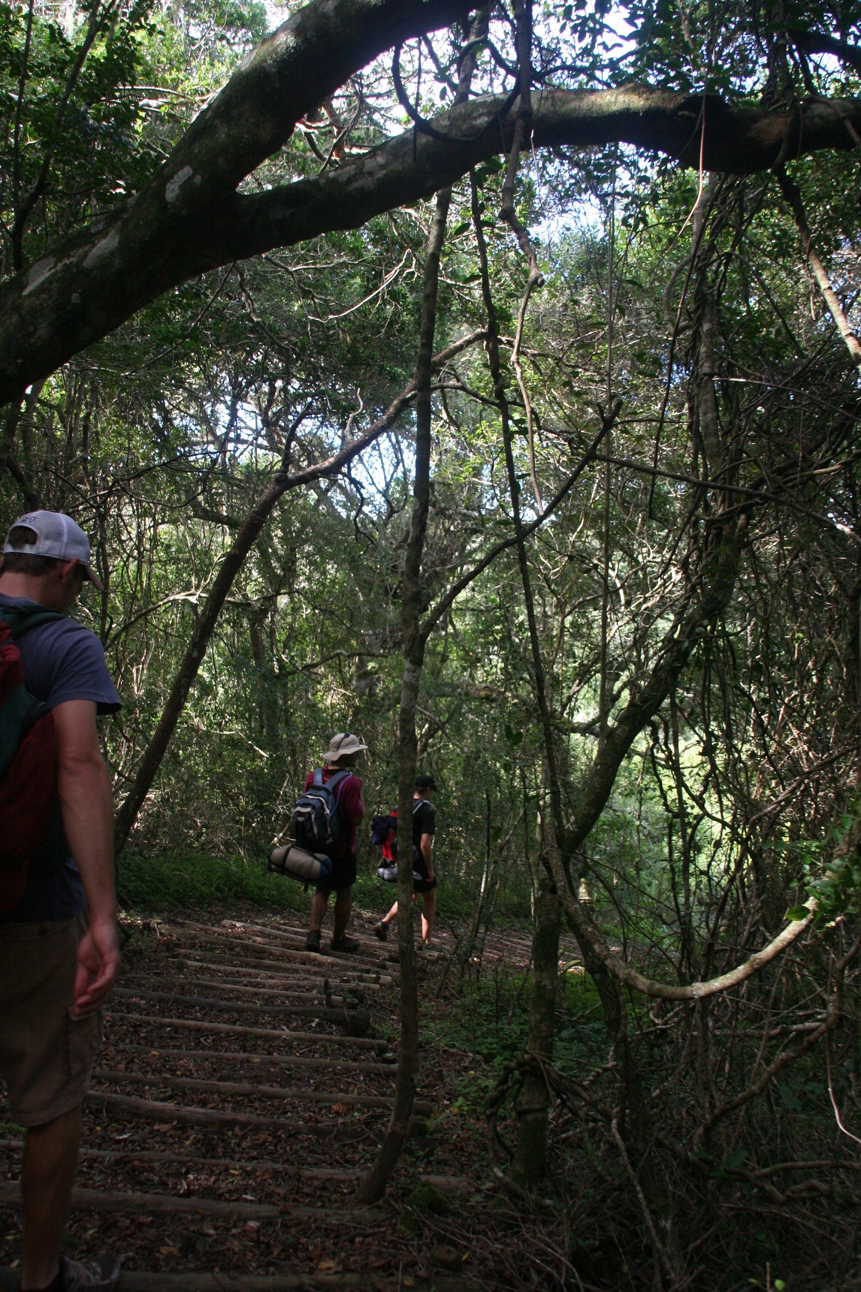
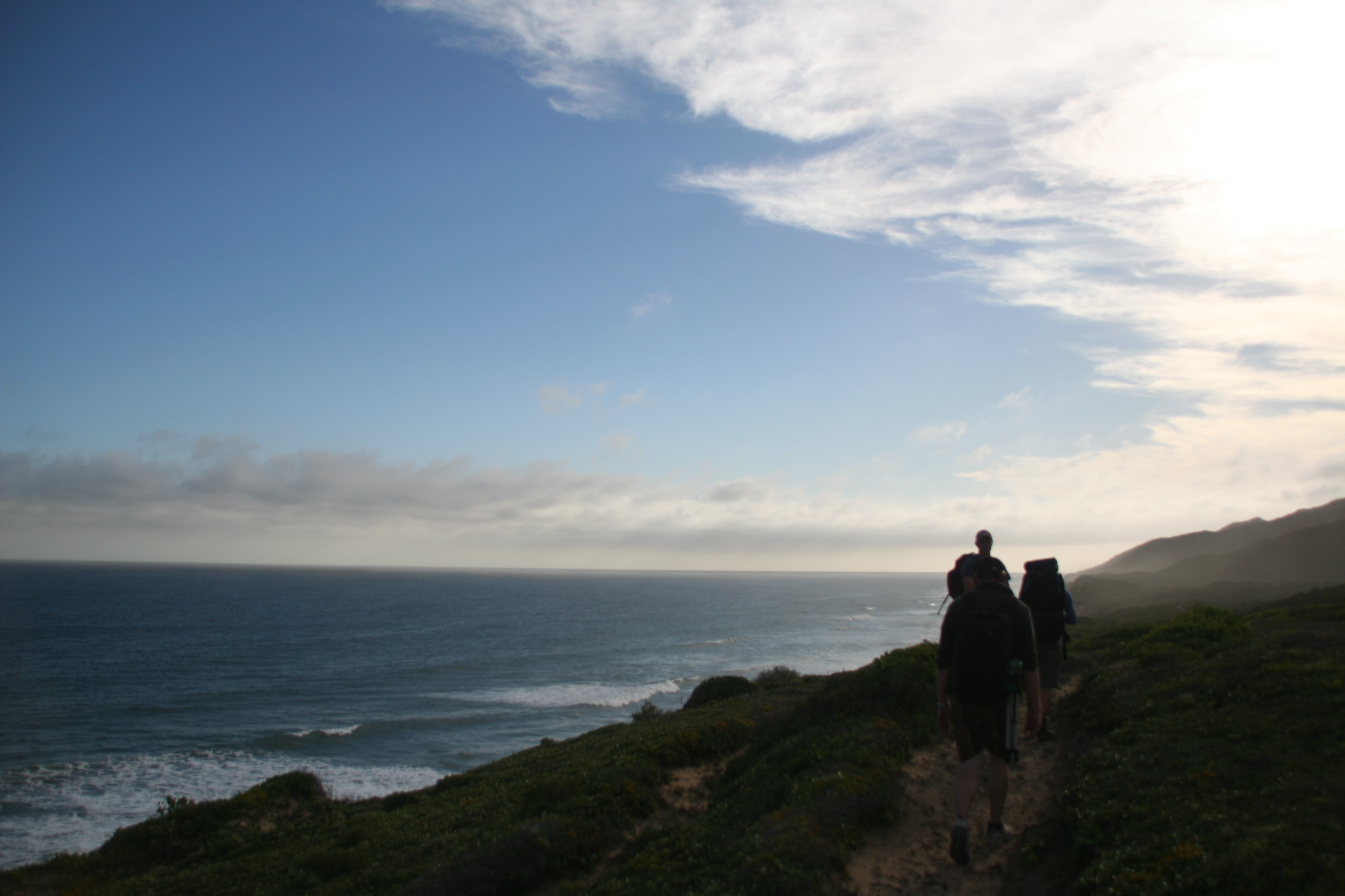
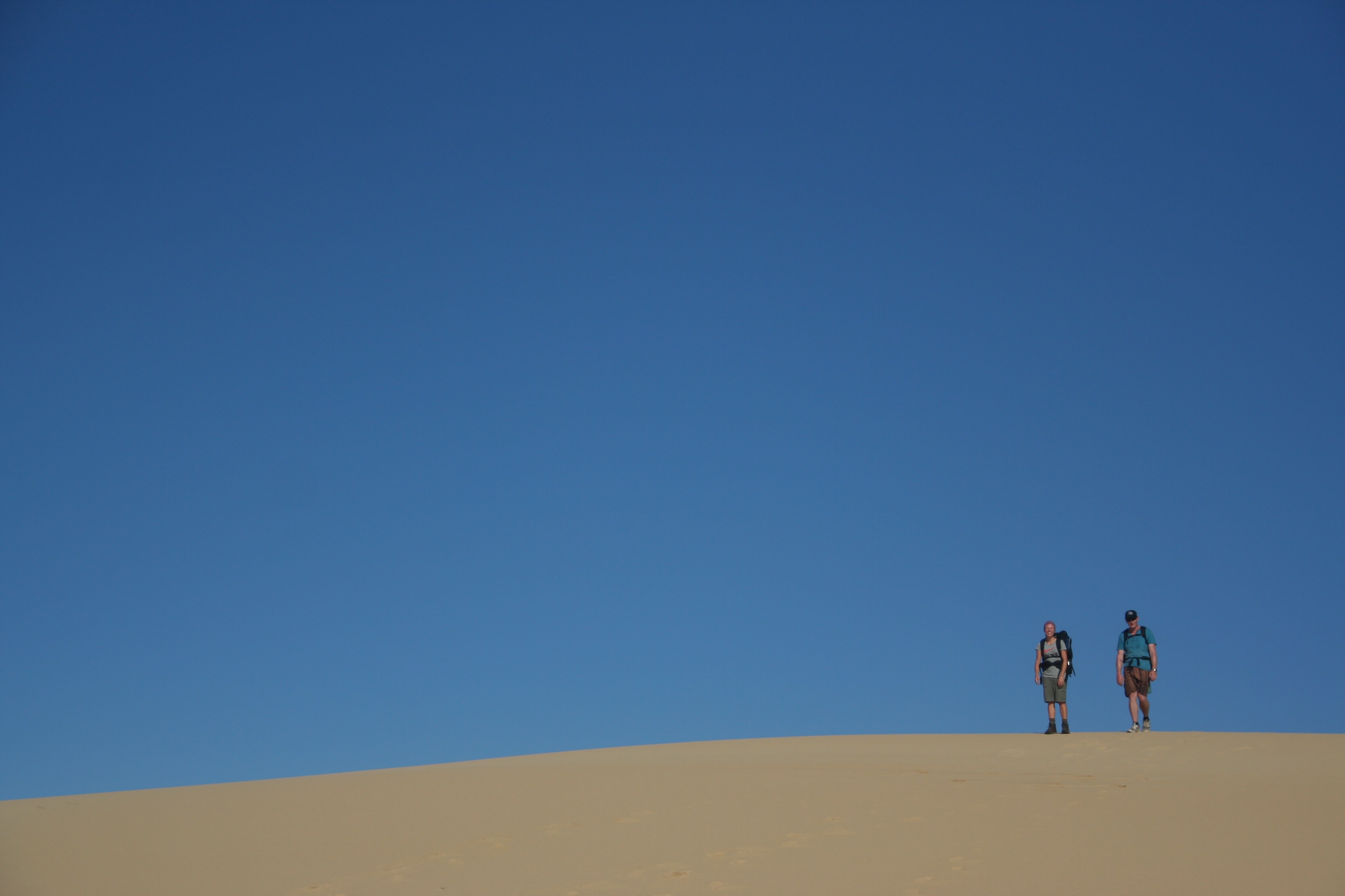
This last weekend I got invited out to the Wildcoast for a bit of mountain-biking. A friend had just got himself a bike and was looking to put it through its paces. Another friend who works at a hospital out by Zithulele suggested we do a ride from the hospital out to a backpackers by Bulungula. A relatively short route (15-20km), but certainly challenging.2013-08-25 11.49.48It ended up with 5 of us starting off from Zithulele on Saturday morning at about 10h30. We weren’t in any particular hurry and ended up riding for about 3 hours, including some backtracking, lots of discussions about which route to take and general breaks to take in the stunning scenery and recover from the never ending onslaught of hills.2013-08-24 10.44.13
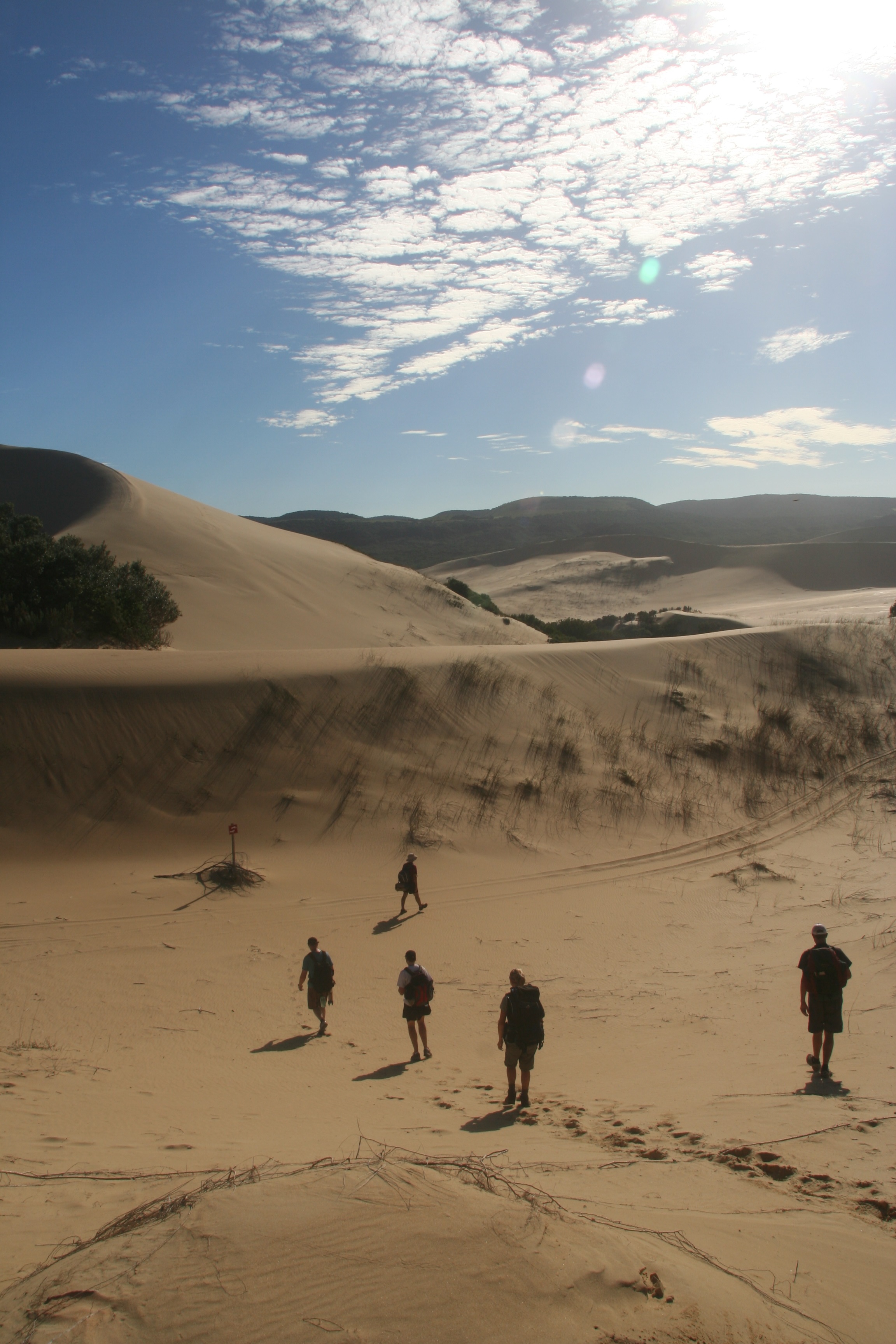
About half the route we ended up doing was on dirt roads of some form, and a lot of the rest was on single track cattle paths which added about of a technical aspect to the ride. The rolling hills mean you get a good dose of killer uphills and flying downhills. One of the most surprising things for me was how many people live out there. Each time you reach the crest of a hill you’re greeted with another view of green fields spotted with houses all over the place.The backpackers can be reached by car, a vehicle with decent ground clearance is probably recommended, but a Citi-Golf and a Ford Bantam were both evident in the parking lot when we arrived. There’s also a shuttle that runs the route (apparently all the way from Mthatha) a couple times a week.2013-08-25 10.23.23
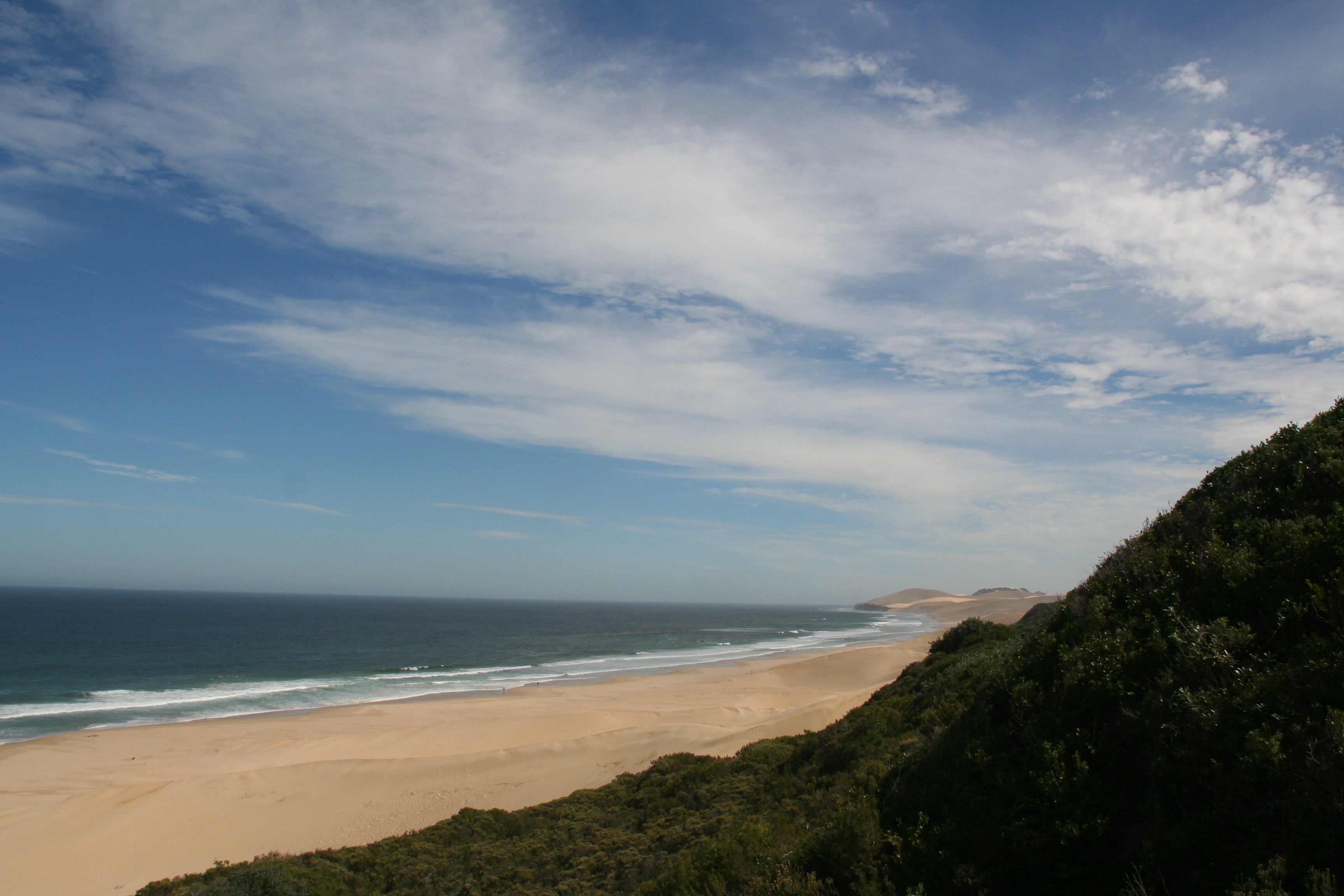
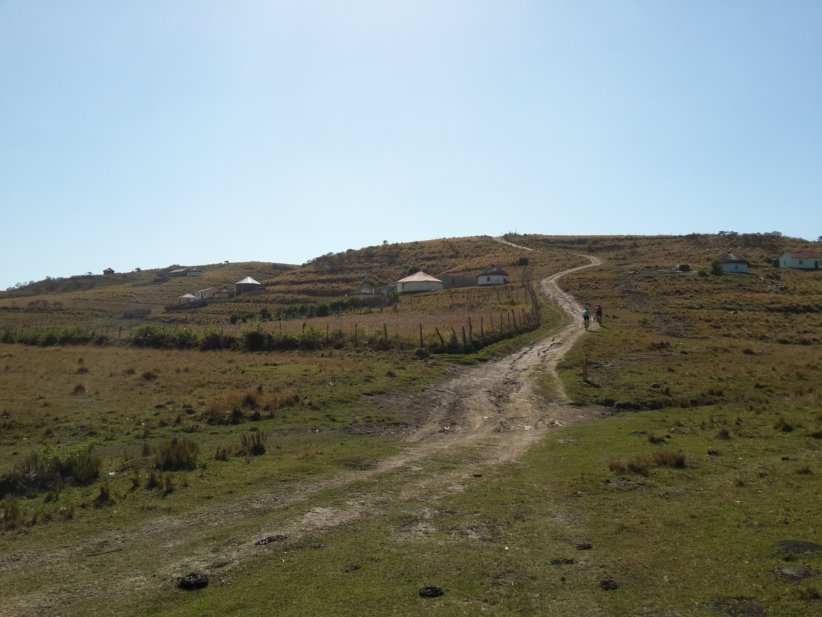
The Bulungula Lodge is situated a stone’s throw from the see and Bulungula River mouth. The facilities are rather rustic, but adequate. We shared 4 bedded huts (R140pp), but other options are available. 3 meals are available a day, of which we sampled all starting with some massive toasted sandwiches for lunch when we arrived. Supper was a delicious wors-stew with gnush and stew, and a dessert of Malva Pudding and ice cream was available. A self-service bar including snacks was also located next to the kitchen. Sunday morning we enjoyed a good breakfast of bacon and eggs with beans, toast and tomato.2013-08-25 11.50.30
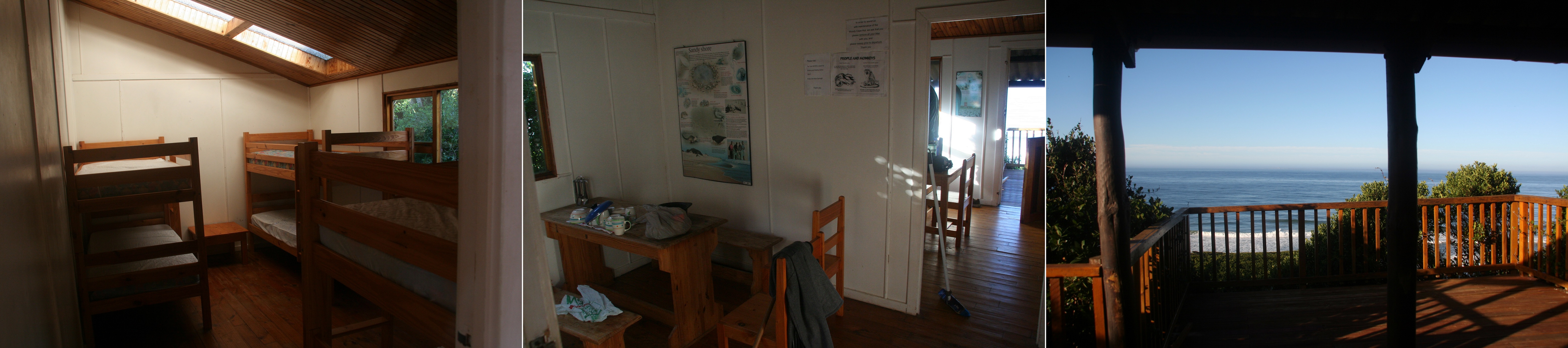
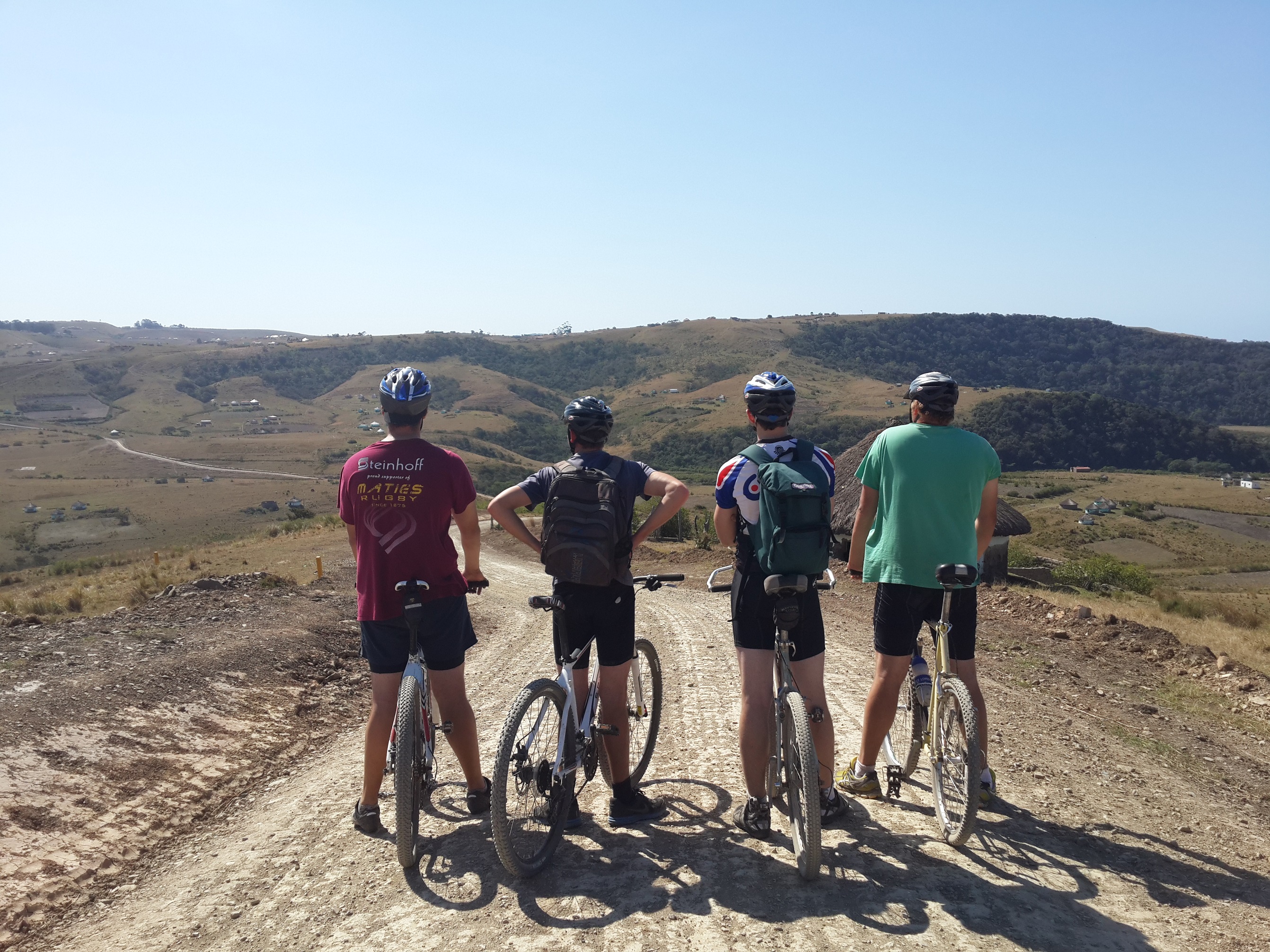
Showers are heated with paraffin ‘rockets’ which provide some warm water for about 7min and enviro-toilets are also provided. The huts have electric lights, but no sockets. There are a few plugs in the communal area, and also a laptop that can be used if you want to use the internet, wi-fi is not available. Cellphone reception is also limited, but can be found out on the beach or in certain areas if required.2013-08-25 10.46.52The backpackers is run mainly by the local community of which there are often people hanging around the area. Not really a problem but a bit odd at times. Crime does not seem to be a problem, doors were only closed (not locked) to keep the goats etc. out. And valuables were often left unattended.2013-08-25 12.51.50
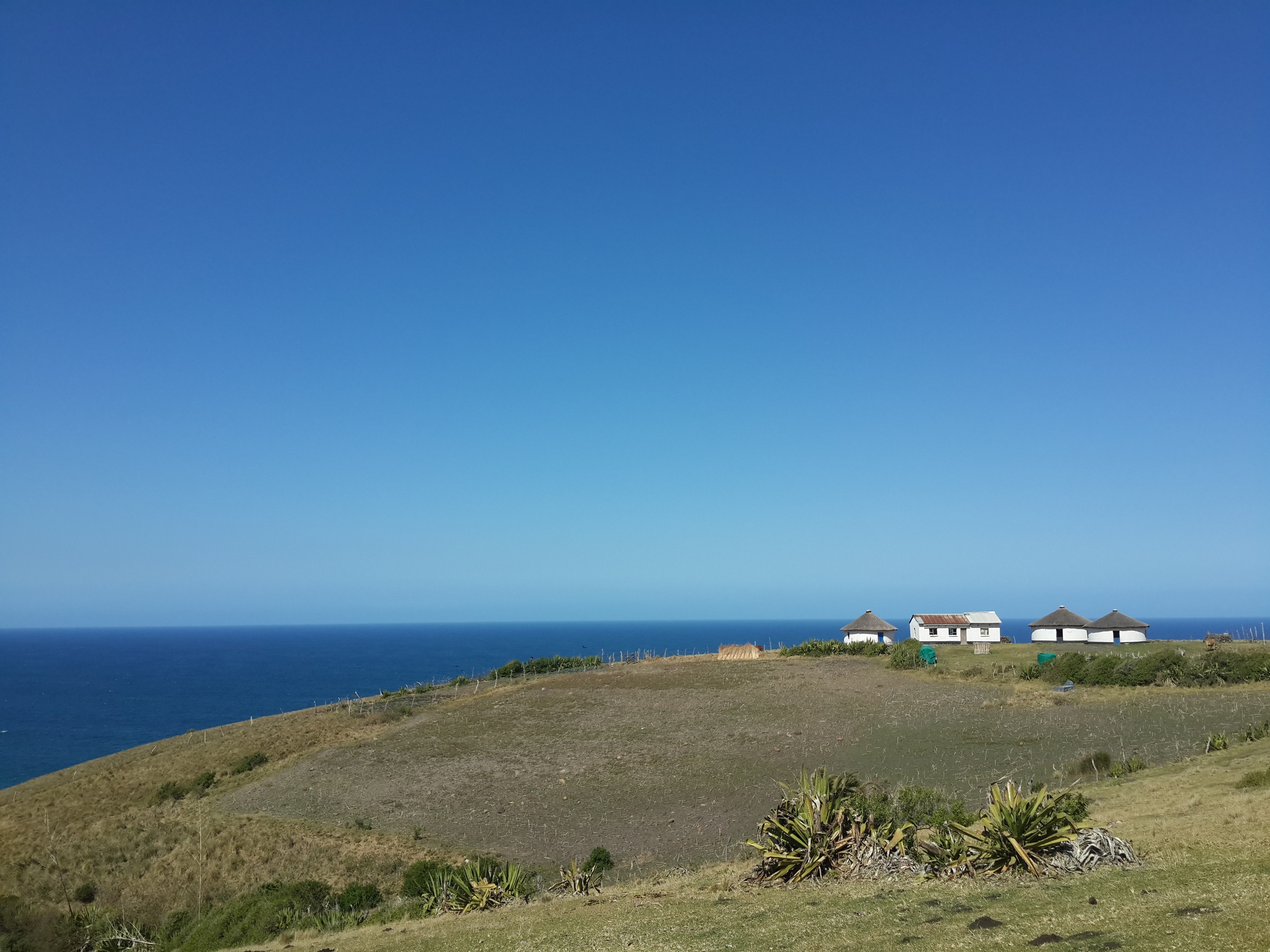
Only annoying issue was when trying to checkout (along with 10 other people) took quite a while as each person’s bill has to be manually tallied and added to their accounting system (excel spreadsheet). And only once all had been completed could we go to another room to pay with a debit/credit card. This facility is handy, but inconvenient in this context. Cash is obviously also accepted. There are also a host of activities in which you can take part, but due to our limited time opted against.2013-08-25 09.15.31
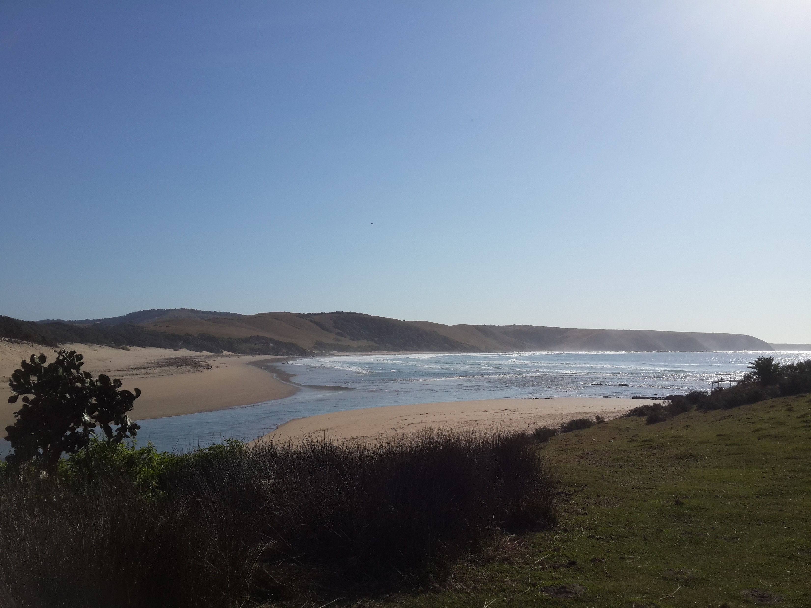
The Sunday morning we headed back to the Zithulele, choosing one or two paths differently but ultimately doing a very similar route to the one we took to get there. Riding a bit faster but being killed again by the reoccurring hills.

2013-08-25 10.07.51
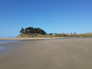
View of Bulungula Lodge from the beach

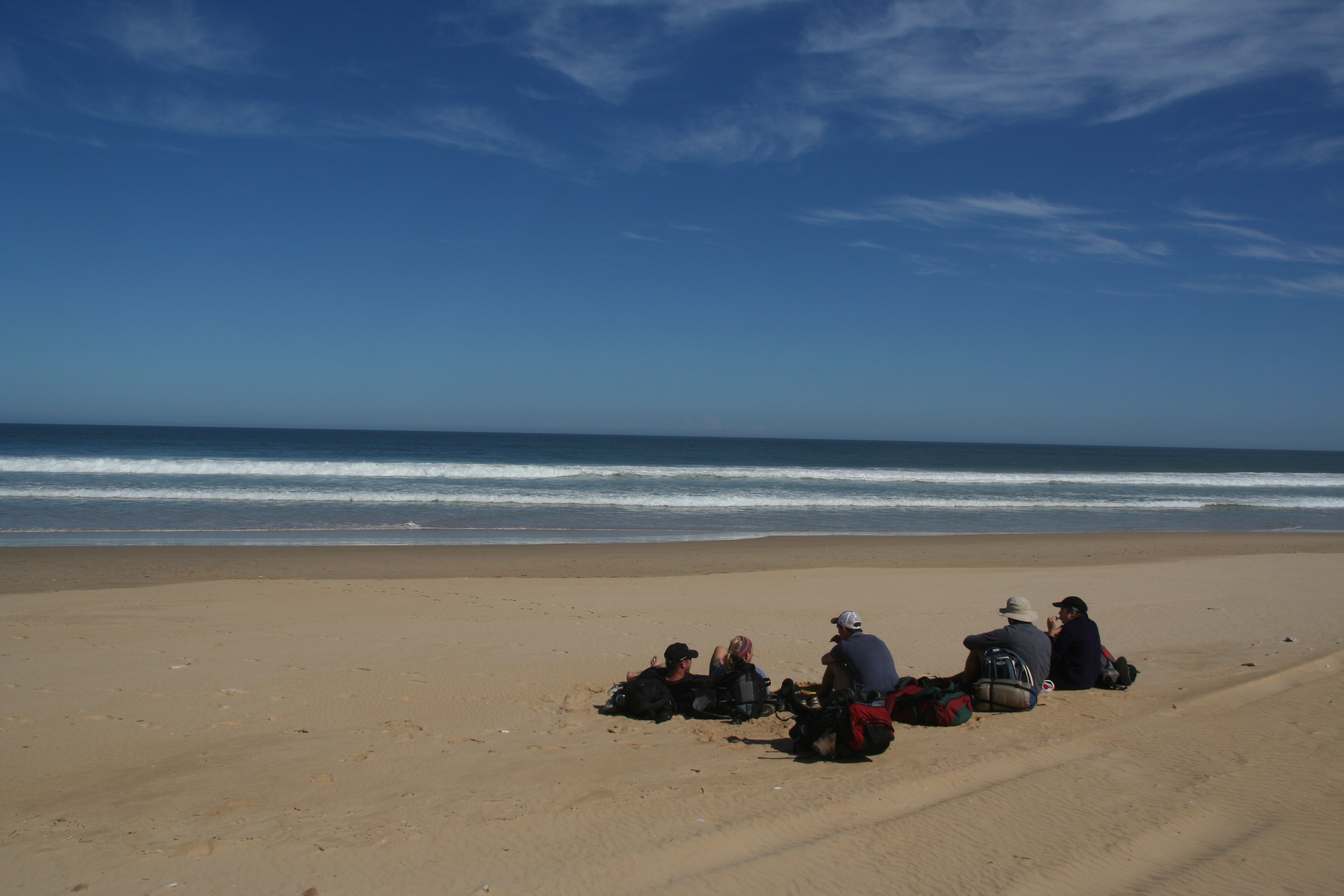
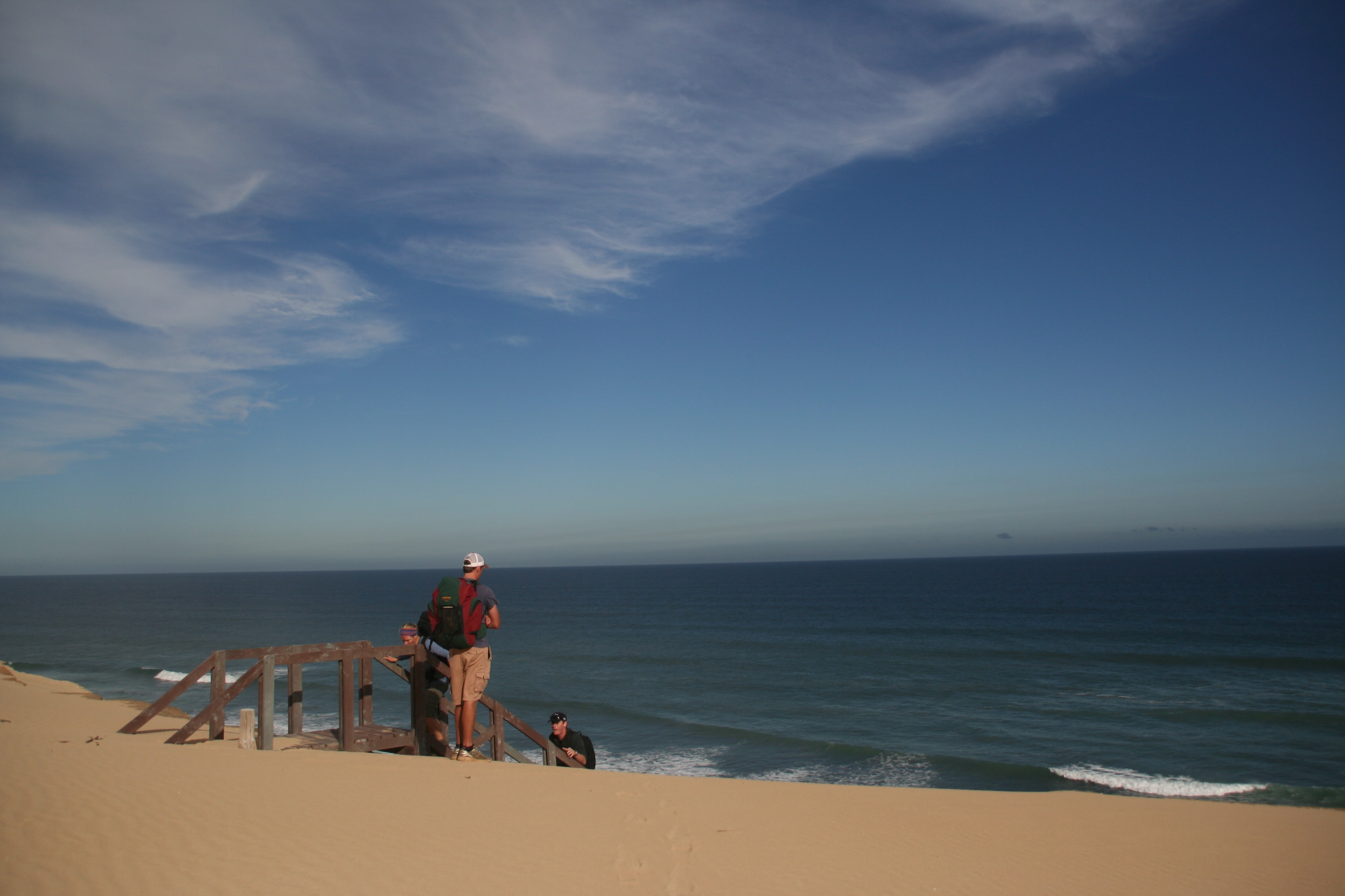
The area is absolutely stunning and it was a great experience being able to just hop on a bike and head out into the wilderness picking a route as we pleased. The backpackers was enjoyable, albeit nothing amazing. Other people from the hospital had also hiked to the backpackers all the way along the coast.

Great company, good weather, some tasty food and beautiful scenery made it an all together memorable weekend.

My adventure Geocaching in Hogsback, in the rain

As part of an elaborate engagement plan for a friend, I ended up in Hogsback a few weeks ago. Myself and a friend were armed with an iPhone, a Galaxy phone and Garmin GPS as well as a set of clues to go hide in 5 Geocaches in the area. It was both of ours first experience in the hobby.

While I’ve tried to not mention any clues which might help to locate the caches we found, I apologise if the intended effort fails.

The plan was to take a set of clues to place in five different already established geocaches. The couple in question would visit Hogsback the following weekend and find all the clues we had hidden, the clues would build up towards the proposal. It wasn’t the best weekend ever to go hiking around outside, but we had a set mission to accomplish.

geocache9 o’clock on Saturday morning we found ourselves driving on a dirt road out of Hogsback towards our first cache at Wolfridge Falls. It was chilly, it was raining and trees were hanging over the road most of the way, and we were having a little trouble with our GPS devices. We found the falls and keeping the hint in mind hunted around for about 20min without any luck. We then thought we had the wrong location and spent the next three quarter’s of an hour walking down the road and up random paths looking for a suitable location.

wolf (Large)

Wolfridge Falls

After getting our GPS functioning again we realised we were originally in the correct place, headed back there and spent another 20min scrambling around looking for the cache. Still no luck. Because this was more than just a personal goal, we caved and gave team iPajero a call. Now with a slightly better idea of where to find the clue; we saw where it most likely was. And thus were able to hide the first clue. It took much longer than we had expected and we decided to hurry on to the find the next cache in the hopes they wouldn’t all take that long to find.

wolf (2) (Large)

Wolfridge Falls cache

Next on the list was Kettlespout falls, a drive back to town and out along another road got us to the parking area to start the hike. A fairly short hike up to the falls, gave us time to turn the GPS on and locate the given GPS coordinates. A short search quickly yielded the cache, in which we logged our finding of it (using the day’s pseudonym, “Cold & Wet”) and planted the second clue.

kettle (Large)

Kettlespout cache

With the quick find giving us a boost of morale we hopped back in the car and headed towards 39 steps. Another short walk and a 10min search yielded our third cache of the day. Alas we had left the clue we were supposed to leave in the cache back in our car so had to walk there and back again to place it in the cache.

39steps (Large)

39steps cache

With the rain refusing to relent, we decided to get all the cache’s done before we dried out and got some lunch. Next on our list was the cache at the Chapel on the Hill. Not actually part of the challenge we were setting up, we went to scout out the location as a fall-back in case something went wrong on the day, or we weren’t able to hide all the clues.

kettlie (Large)

A lovely little chapel surrounded by trees, we had a good look around the area (keeping the hint in mind), searching for possible locations of the geocache. After 10min we found where we thought the cache should be, after half an hour of searching we conceded defeat and gave our friends at iPajero another call. He tried to explain where the clue was relative to the marker we had located, and we immediately realised we were in the wrong place as his description didn’t match what we saw. We then found the actual location of the cache. While our first location still tied up with the hitn provided, it was just unlucky that we found it first and the correct one only later. This was also our first introduction to the nano-cache. We opened it up, but decided not to log the find, mainly due to our unsteady and wet hands at the time.

Much smaller than we expected

Much smaller than we expected

With our enthusiasm taking another slight beating we figured we had to find the other two clues before lunch otherwise we’d probably never get to them. Next on our list was Urst100. I had mapped all the geocaches on a map to figure out an optimal manner to search for them. It wasn’t till we headed towards Urst100, that I read the clue, and saw the GPS coordinates given were for a potential parking place, and not the position of the cache itself. A quick recalculation had us heading out on the same road as the Wolfridge Falls, stopping earlier to hike down to the Madonna and Child Falls.

child (Large)

Urst100 cache

Having decoded the hint, we searched for about 10min before locating the cache and hiding our second last clue. From there we cut across towards our last cache of the day, the Hogsback Big Tree. A bit of trail running through the forest got us to the tree a bit earlier, giving us plenty time to search for the final cache.

Madonna & Child Falls

Madonna & Child Falls

We knew going in that this was going to be a difficult cache to find; many people had previously been unable to locate this cache. Once we got there it took us about 10min to locate the clump of trees in which the cache is located. The hint helps in this regard. Half an hour of searching proved to be fruitless, and it getting later in the day, and our stomachs beginning to tire of the milk bottles and wine gums we had earlier fed them, we decided to place a third call to the helpful team iPajero.

He was able to explain the general location of the cache, but not it’s exact location. Another 20min of searching resulted in another phone call. Another half an hour of searching and we decided to call it a day. We instead chose to hide the final clue in a location that it could be believed to be as part of the cache.

39 Steps

39 Steps

With that we beat a quick retreat to the car and our late lunch. While our first two attempts at securing a meal failed, the third led us to the Butterfly’s Bistro near Hogsback’s info centre. With a fairly wide selection of food and good service we both ended up opting for a delicious steak with vegetables and chips with a glass of gluwein to get us back to room temperature. This further aided by the wood-fire and being granted permission to remove our wet shoes and socks.

Overall it was a long day, sometimes it was great, some times we weren’t the happiest people, but it was a fun experience and is a great story to tell. It wasn’t really the geocaching experience I had expected, but from a challenge perspective was great. We set out from East London at 07h00 and arrive back 12 hours later, having got some good excersize, finding five of the six caches we had set out to locate and hiding the required five clues. Although the weather was lousy, it added to the experience :)

I was delighted to hear the following weekend that our efforts were not for nought, and the proposal all went off without a hitch, and occurred under blue skies to double. My thanks also go to team iPajero for their help in locating the caches, without whose help I don’t know what would have happened.

gcIt was odd to note, that after looking for a while, when you saw a place for hiding a cache, you just had a feeling of knowing it was the correct place. You search for a while, digging around, and then you just see this one random arrangement of rocks, and know that’s where the cache is hidden. Also that although the coordinates were useful for mapping these caches’ locations; for five of the six we found, a GPS device wasn’t actually necessary. Kettlespout required the coordinates, the rest were all located by specific features.

My Geocaching account is Fiddlings.

Woody Cape Hike (aka Alexandria) Hiking trail – April 2013

Since I started university I’ve had the opportunity to do several long hikes over the years. Last year being the first year devoid of any such expedition. There was almost an opportunity to do the Shipwreck Hike over Easter, but plans unfortunately fell through. As such myself and a few friends found ourselves looking for something to do. Being a working man now, a two or three day hike was a bit more feasible than my previous hikes and as such we ended up heading for Alexandria early on Saturday morning.IMG_6340

The Woody Cape hiking trail is a two day hike (18.5km & 13km), through the forests, beaches and dunes of the extended Addo Elephant Park. The hike is a circular route with a 12 person hut at the halfway mark overlooking the sea. The park also includes backpacker style accommodation for 12 people at the start of the hike, which means one is able to stay their the night before and after the hike if you so choose. The park is however a short drive out of Port Elizabeth, and even for us coming through from East London on the Saturday morning was no hassle.IMG_6350

The park seemed fairly quiet while we were there, we also had no problem booking the trail in the week before we wanted to hike. The cost for the hike is R120pp which is for the hike and the hut. A further R40pp SANPark Conservation fee is required. You may be required to pay this for each day you are in the park. If you wish to stay at the accommodation before or after your hike, that is a further R120pp per night.IMG_6355

The hike starts out through the Alexandria forest for about 8km, there’s a slight up and down before you start descending towards the sea. At this point you walk through 2km of farmland and ending on the beach. You then hike for about 6km along the beach. After the first 4km you come to a set of cliffs. At this point the route carries on along the base of the cliffs for 2km, however it is impassable at high tide. We ended up going through about two hours after high tide and there was ample space to keep your feet dry. If you do completely mess up your timing, it is apparently possible to climb up the dunes to your right and head along on the top of the cliffs.IMG_6385

Once you complete the last 2km along the bottom of the cliffs you’ll comeĀ  to a rope and a set of stairs to help you ascend the dunes to the top of the cliffs. The last 3km of the day take you along the top of the cliffs through some bushy areas to the cabin. Be sure to keep left along this section as we happened to miss a sign and had to do some bundu-bashing at one stage to get back on track.IMG_6420

The hut itself was great. It’s up high and has a stunning view looking out over the sea. Two bedrooms with 3 bunk beds each provide sleeping place for 12. Tables and chairs for all are also provided. Although not advertised, when we arrived we found the hut to have a two plate gas stove, with full canister, a fully stocked cupboard with pots, pans crockery and cutlery, more than enough for us. We had brought all equipment and gas stoves for ourselves, and it’s advised that you check with the park before arriving at the hut only to find it all missing. Rain water is provided from two large tanks, which can be used for washing and drinking. No other water sources are found along the route and no showers are provided at the hut. Two toilets (and toilet paper when were there) are available a short way from the hut.IMG_6442

Unless it’s very warm, I advise closing your doors once it gets dark. While eating supper we had three bats come and visit us, who swooped around and around the kitchen for quite a while before finding their way out.IMG_6451

Day two although slightly shorter than day one is probably a little bit tougher. You first cover 2 km through the bushes before coming out on the dunes. The dunes are absolutely spectacular, but it can be quite a long, hot hike for the next 5 km. Signs with footprints on them guide one all the way across the dunes, although a bit of looking ahead can make the crossing a bit easier. After the dunes you cover another km though farmlands before a long 2 km climb up to the forest. After this a leisurely stroll back to the start point gets you safely home.IMG_6462

On day one we started at about 09h00, with high tide at 13h20, we were set to hit the cliffs at exactly the high tide peak. Just before one reaches the beach you come across the fairly recently opened Woody Cape Backpackers. A fairly rustig joint just behind the dunes. it’s impossible to miss and we decided to grab a lunch time beer when we got there to delay our arrival at the cliffs. They offer some meals and other facilities, although depending on the day you may want to phone ahead to guarantee they’re open.IMG_6508

Another stop halfway along the beach for lunch and an afternoon snooze put us well on the receding side of high tide by the time we got to the cliffs. We made it to the hut by 16h40.IMG_6544

Day two we got going just after 08h00 and arrived back at the start around 13h00. Our group was relatively fit, but hiked at a leisurely pace most of the way.

The hike is a really great weekend getaway, especially if you stay nearby. You hike through several vastly different surroundings, each as stunning as the next. The dirt road to the start of the hike is easily drivable in any vehicle, and cover is provided if you’re staying overnight. The facilities were top notch and supported by friendly staff.IMG_6345

You can find contact details for booking here. For more information have a look here, here and here.

Kalahari/Kgalagadi 2012

With all my work pretty much on track, I took two weeks off to get out a bit. First a few days back in the Cape catching up with some friends, then a bus trip later to spend some time with my girlfriend in the Northern Cape, where I had the opportunity to travel 1.6km below ground. Certainly the lowest altitude I’ve ever been at, or expect to ever reach.

We then joined up with my parents, and later the rest of my gesin and some other family for a seven day trip to what is currently known as the Kgalagadi Transfrontier National Park, previously known as the Kalahari Gemsbok Park.

S.Africa – Botswana

The stage opens at an odd looking building that is split right down the middle (including the parking lot outside) to indicate the South Africa/Botswana border. Large sections of the park reside on both sides of the border, and it was with the formation of the Transfrontier park that a border post was established here allowing one to travel extensively in the park.

Our trip consisted of a night in TweeRiveren, three nights camping at Nossob and two nights in the lovely (unfenced) Kalahari Tented camp. Most days consisted of a game drive or two, including trips between the camps. Although the roads are bearable, certain sections have fairly bad corrugations. Made me thankful we were in a rental and not my own car.

Gemsbok

Although there are no vehicle restrictions in the park (a small fiat and Toyota Tazz were spotted deep into the park) and roads are passable, a more comfortable ride would be had in a vehicle more suited to off-road driving. The major advantage with these vehicles is the added height, enabling one to see over the bushes and grass that line most of the roads.

The most prolific species we saw was probably the Springbok, followed closely by Gemsbok and Wildebeest. They are in no short supply. Ostriches, Kudu, Eland, Hartebees and Giraffe are also to be seen, depending on where one travels.

Giraffe

The park also plays host to Lion, Leopards and Cheetah, but there is no guarantee of seeing any of these. Birds however! Birds are everywhere. Every drive we made included multiple sightings of Kori Bustards, Secretary Birds and Pale Chanting Gosshawks (abbreviated to PCGs). Along with the PCGs are a wide array of other raptors. We saw several species of Eagles, Owls and miscellaneous Hawks and a Vulture or two.

Martial Eagle – Bataleur – Verreaux’s (Giant) Eagle Owl with Hornbill prey in claws

We were there in the middle of July. Some snow storms down south (the N1 outside Beaufort West was closed) led to a few extremely cold nights. Most nights went negative, making it very difficult to get up some mornings. I believe -5 deg C was the lowest temperature we measured when on a drive. That being said we also had some amazing weather. First few days were slightly cool, but our last few saw most people breaking out the shorts as temperatures hit close to 30 deg C.

Pale Chanting Goshawks – Sparrowhawk? – Glossy Starlings attacking our potjie leftovers

Our most exciting aspect was probably our multiple Cheetah sightings. On our trip from TweeRivieren to Nossob we stopped alongside a group of cars to view a group of several Cheetah off in the distance, barely visible without binoculars. The next day while trying to make out a leopard in a tree (I don’t count this as a proper sighting), five cheetah (we assume the same ones) made there way out to a waterhole.

First Cheetah Chase

The exciting part came the next day when we witnessed them on a short-lived hunt on a herd of Springbok, which was unfortunately unsuccessful. Later that evening they tried again at waterhole by Nossob, also unsuccessful. It was fascinating to view a herd of Wildebeest, who were nearby band together and chase off the group of Cheetah (now down to four members). Later that night they were spotted just in front of us on a night drive.

Cheetah being chased off by Wildebeest herd

We saw, what we think was them, once more on our last day heading out shortly after they had finished a meal on a baby Eland which we found several hundred metres from them.

Leopard that we saw

Our camping at Nossob was quite pleasant. Electricity is turned off between 22:00 and 06:00 at night, and the use of communal ablutions means you’re not always guaranteed a hot shower, I had one or two showers which were just bearable.

Ground Squirrels are quite common, especially at Nossob

Kalahari Tented is absolutely beautiful, with individual building/tent combos situated 50-100m apart from each other overlooking the river bed and a water hole. This unfenced camp can make one quite nervous, especially at night when doing a quick dash from one hut to the next.

Springbok – Wildebeest

We had an amazing time there, and were very fortunate to see all we did, even if we managed to complete miss all the lion. We saw enough Lion spoor to keep a tracker busy for days though. So they are there :) Our night drive from Nossob was very pleasant, saw a Brown Hyena, several owl, the Cheetah and several other interesting animals which are more readily viewed at night. The drive was made enjoyable by our knowledgeable and friendly guide Anna, who wasn’t disheartened when she mentioned how one never sees Caracal or Cape Foxes during the day, only for us to tell her how we’d seen both species the previous day.

Southern White-Faced Owl

One is free to drive through the park between sunrise and sunset (07:30-18:00 while we were there) and each camp has several morning,day and night rides available. The experience of lying in your tent, in the freezing cold and hearing Lion’s roar (what sounds like right outside) in the dead silence of night is something incredible, and a sure occurrence, especially at Nossob.

On a side note, we hired a VW Kombi T5 tdi. I’m not sure which specific engine it had, but I’m quite sure I stalled less times while learning to drive than I did driving that vehicle for 7 days. I’m not sure what exactly made it give up so easily, but as soon as the revs dropped below 900, the engine would just die. This happened quite often on the dusty roads when slowing down to look at something, not being able to hear the engine over the noise from the corrugations. Besides that it was a very comfortable, reliable vehicle and the high seating position lends itself for game viewing.