Woody Cape Hike (aka Alexandria) Hiking trail – April 2013

Since I started university I’ve had the opportunity to do several long hikes over the years. Last year being the first year devoid of any such expedition. There was almost an opportunity to do the Shipwreck Hike over Easter, but plans unfortunately fell through. As such myself and a few friends found ourselves looking for something to do. Being a working man now, a two or three day hike was a bit more feasible than my previous hikes and as such we ended up heading for Alexandria early on Saturday morning.IMG_6340

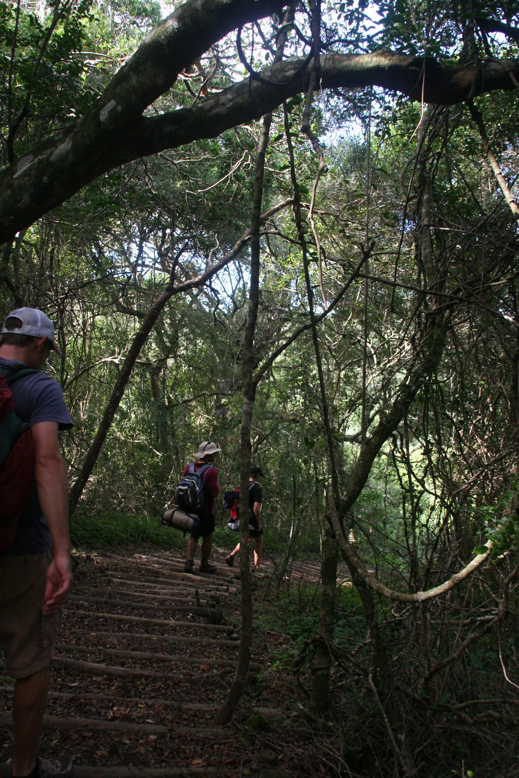
The Woody Cape hiking trail is a two day hike (18.5km & 13km), through the forests, beaches and dunes of the extended Addo Elephant Park. The hike is a circular route with a 12 person hut at the halfway mark overlooking the sea. The park also includes backpacker style accommodation for 12 people at the start of the hike, which means one is able to stay their the night before and after the hike if you so choose. The park is however a short drive out of Port Elizabeth, and even for us coming through from East London on the Saturday morning was no hassle.IMG_6350

The park seemed fairly quiet while we were there, we also had no problem booking the trail in the week before we wanted to hike. The cost for the hike is R120pp which is for the hike and the hut. A further R40pp SANPark Conservation fee is required. You may be required to pay this for each day you are in the park. If you wish to stay at the accommodation before or after your hike, that is a further R120pp per night.IMG_6355

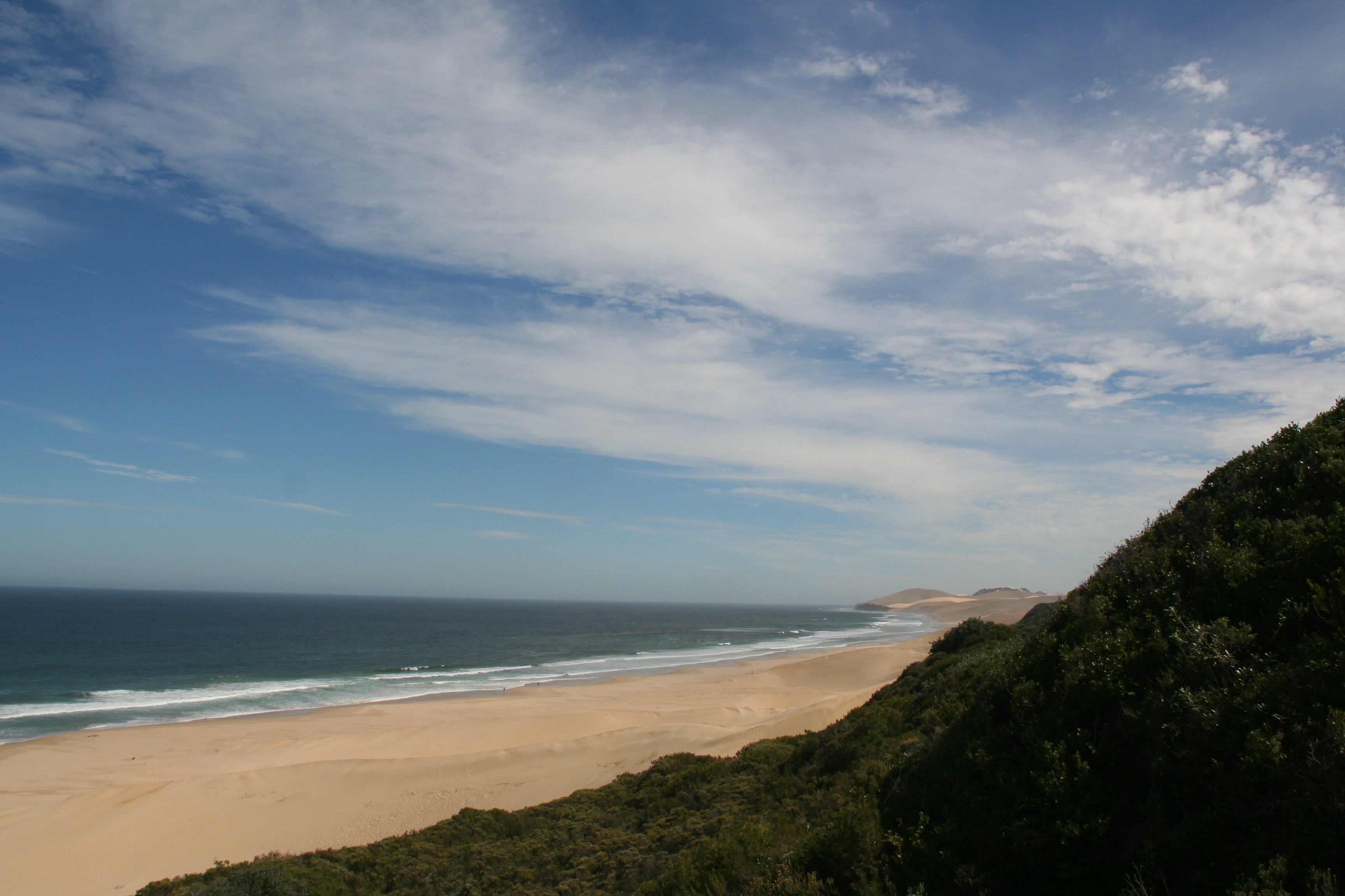
The hike starts out through the Alexandria forest for about 8km, there’s a slight up and down before you start descending towards the sea. At this point you walk through 2km of farmland and ending on the beach. You then hike for about 6km along the beach. After the first 4km you come to a set of cliffs. At this point the route carries on along the base of the cliffs for 2km, however it is impassable at high tide. We ended up going through about two hours after high tide and there was ample space to keep your feet dry. If you do completely mess up your timing, it is apparently possible to climb up the dunes to your right and head along on the top of the cliffs.IMG_6385

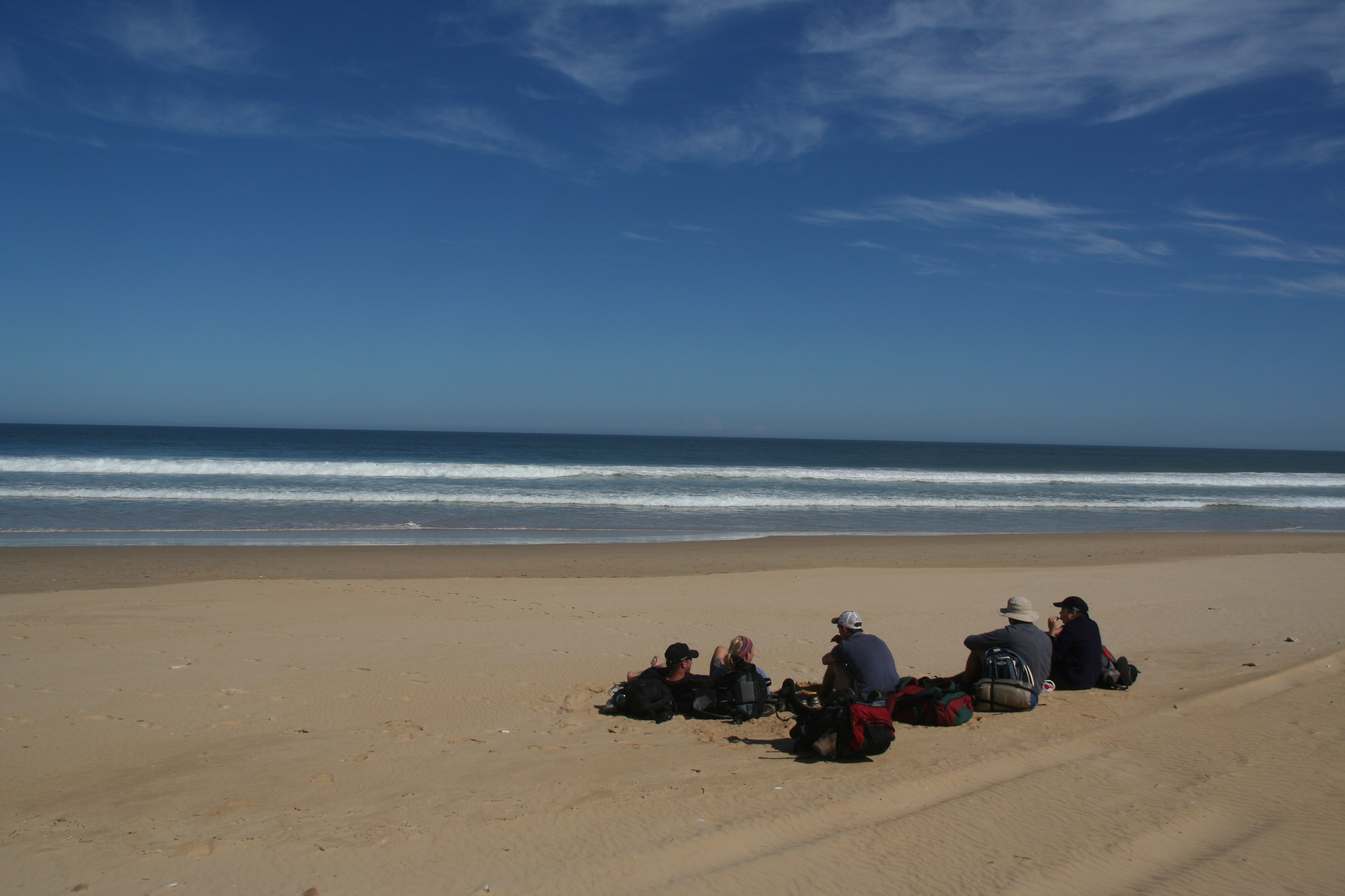
Once you complete the last 2km along the bottom of the cliffs you’ll come  to a rope and a set of stairs to help you ascend the dunes to the top of the cliffs. The last 3km of the day take you along the top of the cliffs through some bushy areas to the cabin. Be sure to keep left along this section as we happened to miss a sign and had to do some bundu-bashing at one stage to get back on track.IMG_6420

The hut itself was great. It’s up high and has a stunning view looking out over the sea. Two bedrooms with 3 bunk beds each provide sleeping place for 12. Tables and chairs for all are also provided. Although not advertised, when we arrived we found the hut to have a two plate gas stove, with full canister, a fully stocked cupboard with pots, pans crockery and cutlery, more than enough for us. We had brought all equipment and gas stoves for ourselves, and it’s advised that you check with the park before arriving at the hut only to find it all missing. Rain water is provided from two large tanks, which can be used for washing and drinking. No other water sources are found along the route and no showers are provided at the hut. Two toilets (and toilet paper when were there) are available a short way from the hut.IMG_6442

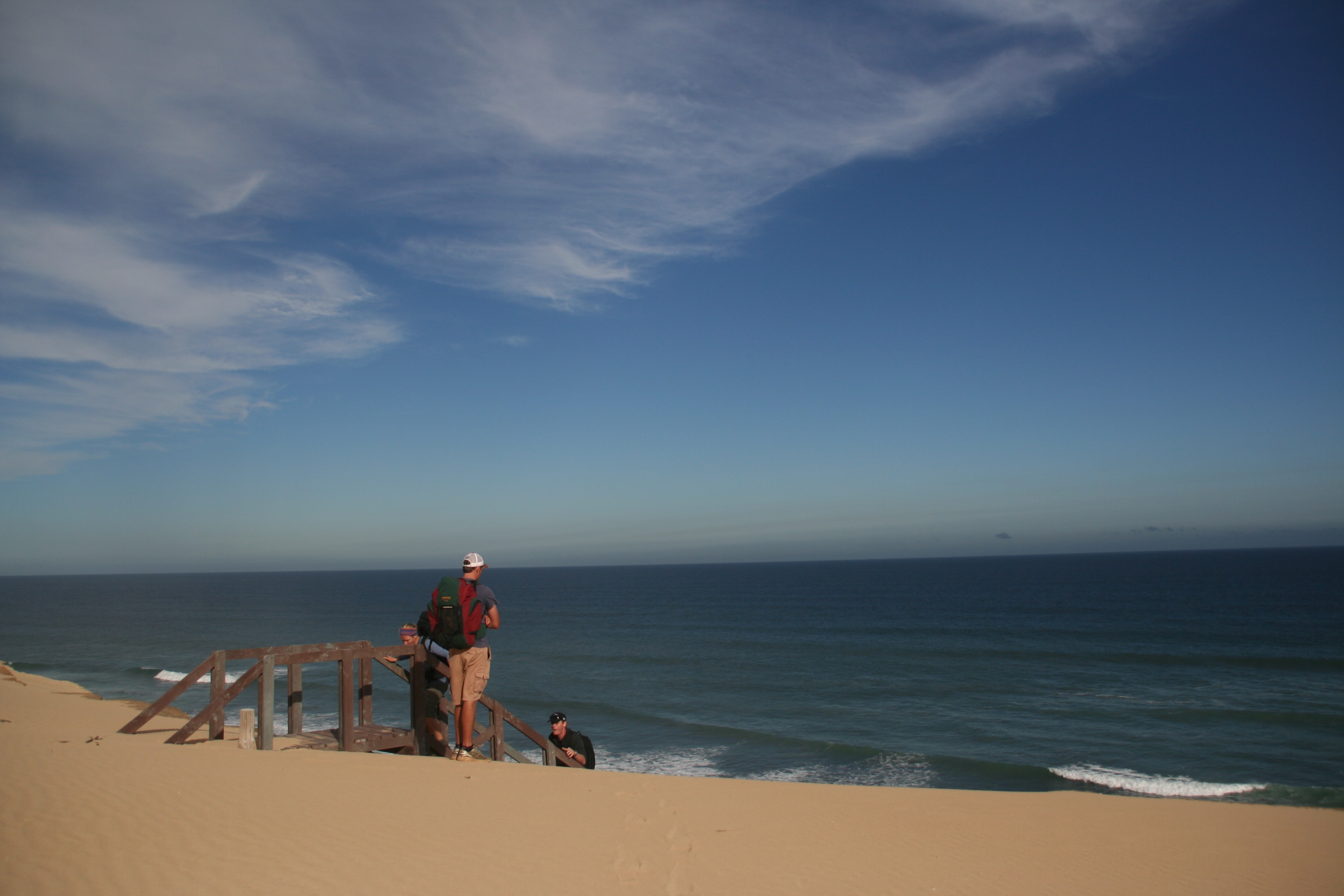
Unless it’s very warm, I advise closing your doors once it gets dark. While eating supper we had three bats come and visit us, who swooped around and around the kitchen for quite a while before finding their way out.IMG_6451

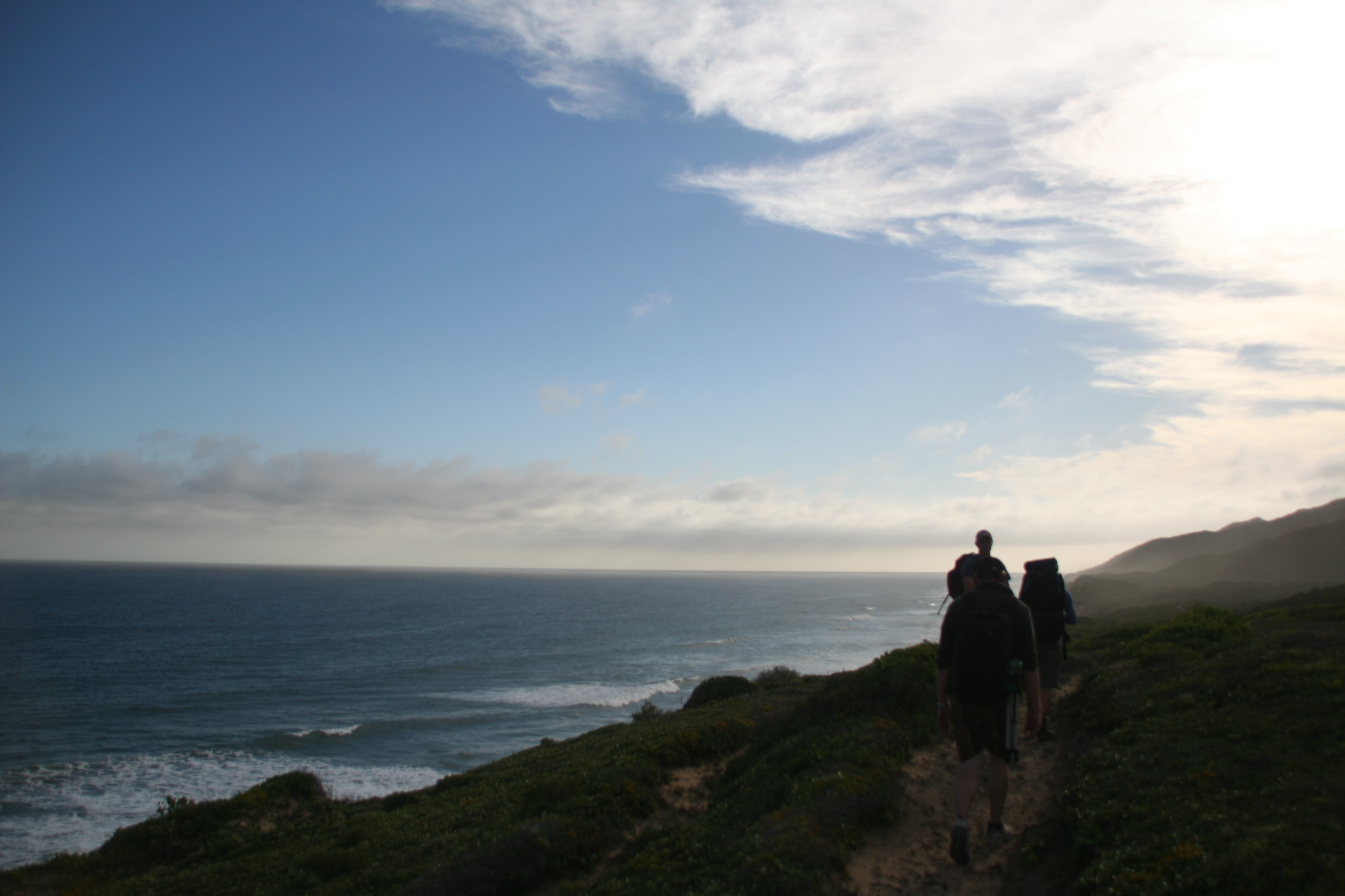
Day two although slightly shorter than day one is probably a little bit tougher. You first cover 2 km through the bushes before coming out on the dunes. The dunes are absolutely spectacular, but it can be quite a long, hot hike for the next 5 km. Signs with footprints on them guide one all the way across the dunes, although a bit of looking ahead can make the crossing a bit easier. After the dunes you cover another km though farmlands before a long 2 km climb up to the forest. After this a leisurely stroll back to the start point gets you safely home.IMG_6462

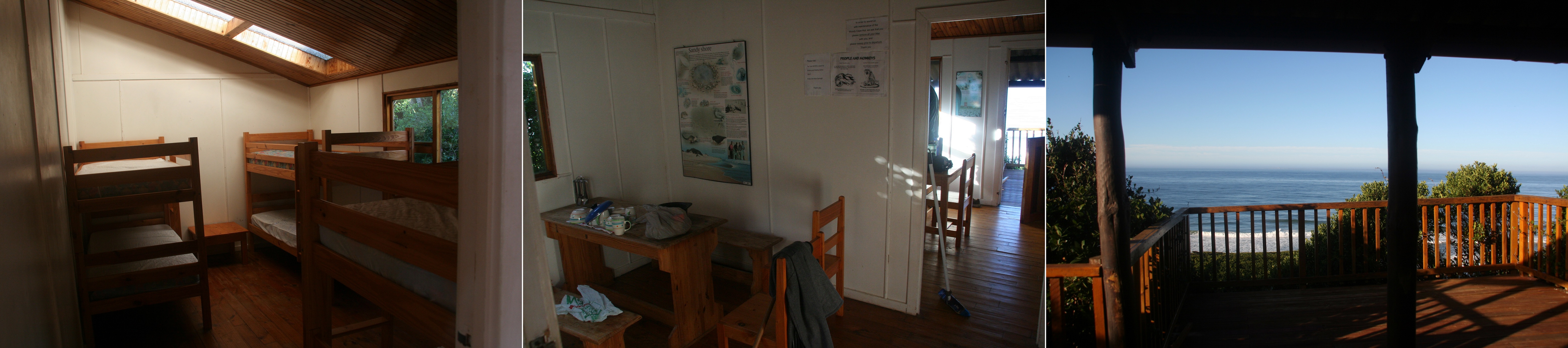
On day one we started at about 09h00, with high tide at 13h20, we were set to hit the cliffs at exactly the high tide peak. Just before one reaches the beach you come across the fairly recently opened Woody Cape Backpackers. A fairly rustig joint just behind the dunes. it’s impossible to miss and we decided to grab a lunch time beer when we got there to delay our arrival at the cliffs. They offer some meals and other facilities, although depending on the day you may want to phone ahead to guarantee they’re open.IMG_6508

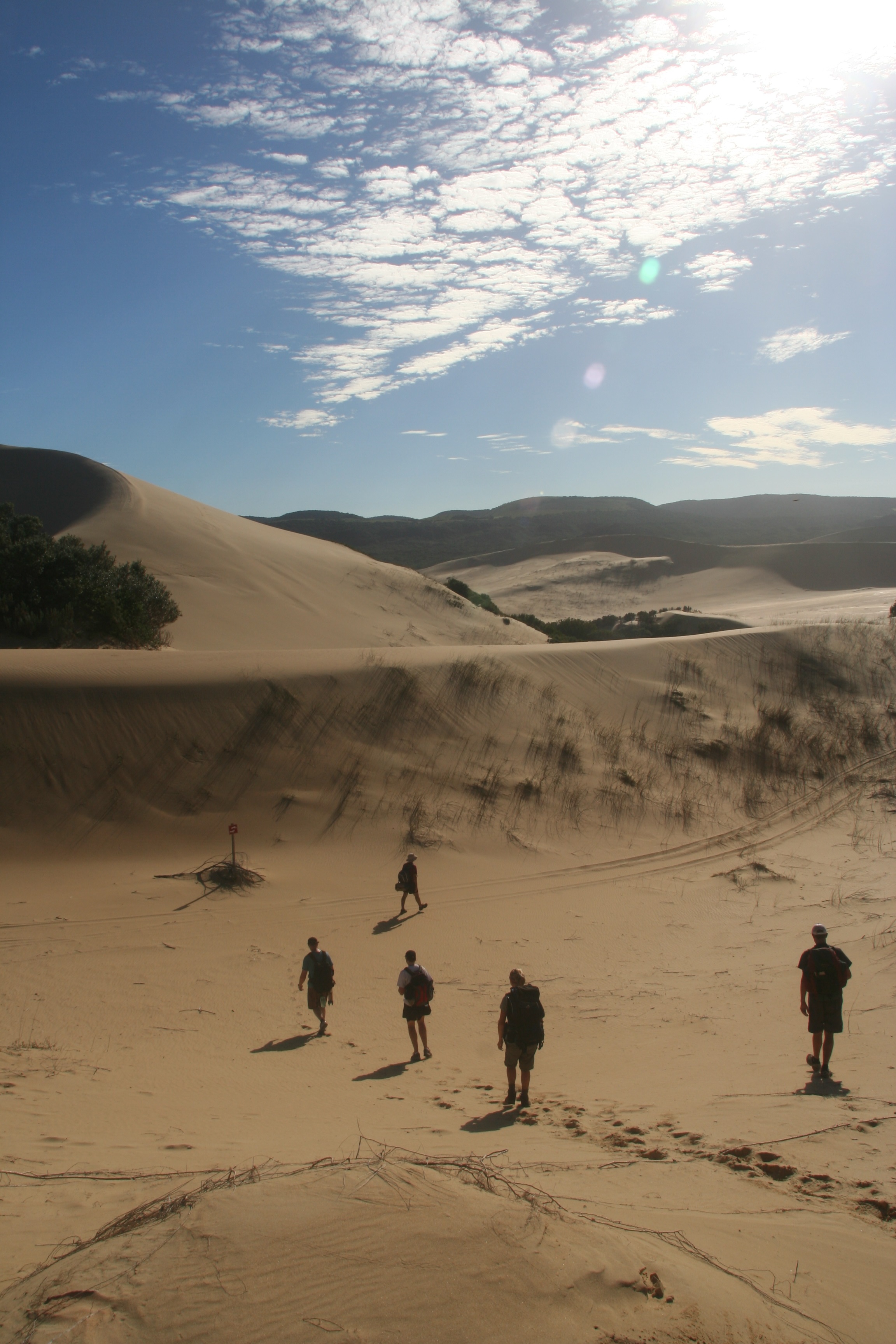
Another stop halfway along the beach for lunch and an afternoon snooze put us well on the receding side of high tide by the time we got to the cliffs. We made it to the hut by 16h40.IMG_6544

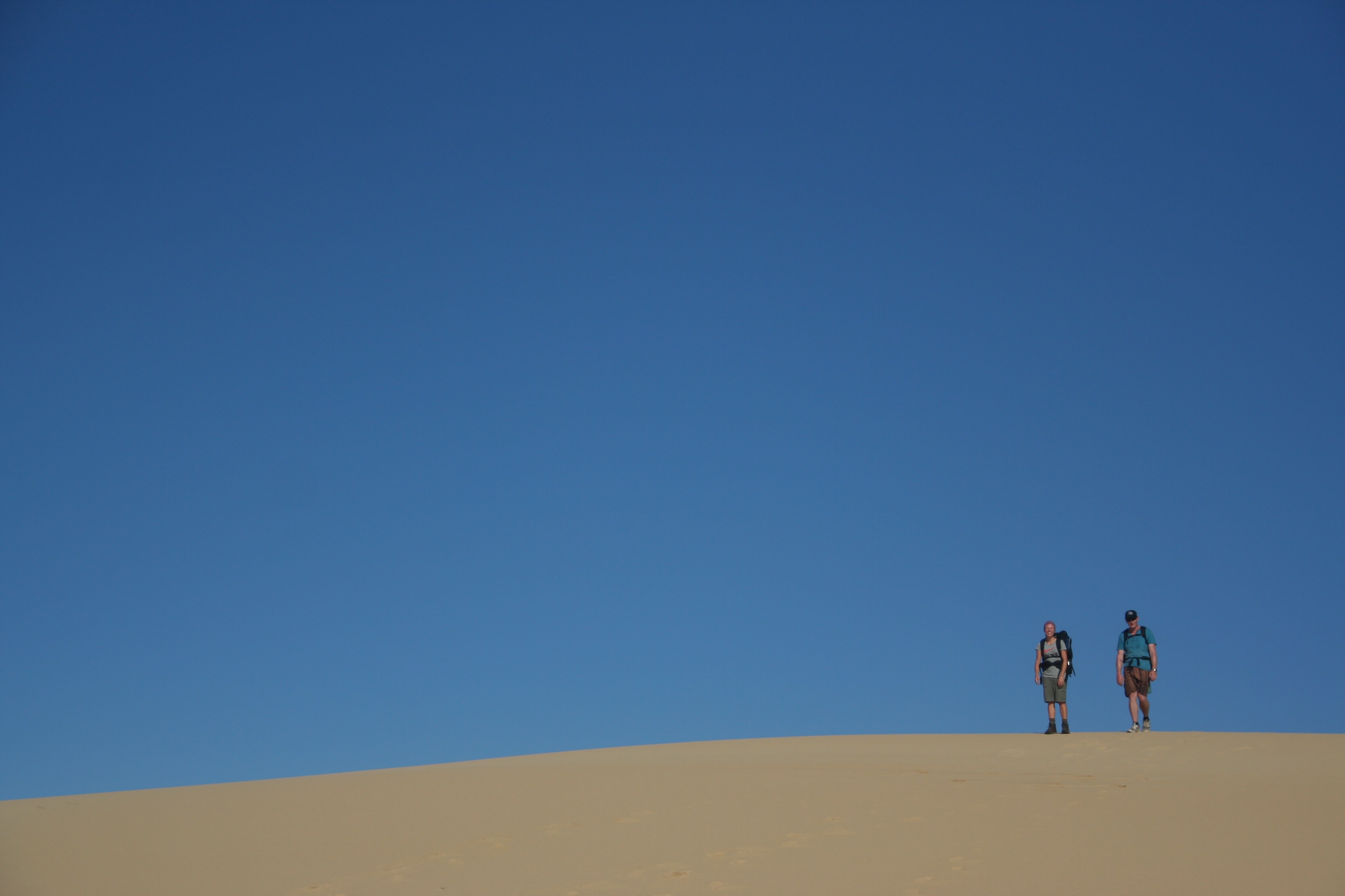
Day two we got going just after 08h00 and arrived back at the start around 13h00. Our group was relatively fit, but hiked at a leisurely pace most of the way.

The hike is a really great weekend getaway, especially if you stay nearby. You hike through several vastly different surroundings, each as stunning as the next. The dirt road to the start of the hike is easily drivable in any vehicle, and cover is provided if you’re staying overnight. The facilities were top notch and supported by friendly staff.IMG_6345

You can find contact details for booking here. For more information have a look here, here and here.

Amatola Hiking Trail

I recently (Nov 2011) had the opportunity to hike the Amatola Hiking from King WIlliams Town to Hogsback. A group of five other engineers and two BSc graduates made for great company along the 100km we covered in 6 days.

Each day’s route leads from one hut to the next. Five huts in total provided us with a warm place to rest, a reasonably soft bed to sleep on, and somewhere to cook. The Amatola trail is rated as one of the toughest hikes in Southern Africa, and although I’m a fairly bad judge of such things, I am quite likely to accept other people’s opinions on these matters. It must be said that it is an extremely beautiful hike. Majority of your progress is made through natural forest which reveals the widest variety of fungus you’ll ever see along with splendid displays of waterfalls.

We drove up from Stellenbosch, spending the night in a backpackers in PE (Lily Pond Backpackers – good facilities, well priced), and then heading on to Hogsback to spend the night before the first day. Both the night before, and after the hike we spent at Away with the Fairies Backpackers in Hogsback, quite nice huts, although the geyser didn’t make it halfway through our group when we finished the hike. That being said we did have warm water in the morning again, and the rooms were well kept and clean.

We caught a lift with a guy called Lawrence who picked the eight of us and our gear up at 6AM in Hogsback and dropped us at our starting point just outside of King William’s Town. After having driven up in pouring rain and going to sleep with thick fog, it was nice to wake up to some slightly overcast weather.

We carried a fairly nice map which displayed the various paths one can follow along with estimated times to complete. Day 1 was supposed to be about 16km, but we think we somehow managed a route less than 12km, as we did fairly amazing time to the first hut (Gwili-Gwili) arriving some time before 1PM.

On arrival we were greeted by cleaners busy neatening the hut and a man tending to the fire of a hot water donkey. In the past it seems that some huts contained gas water heaters or other apparatus, but when we did the route each hut had a standard fire heated donkey. So day one ended fairly early and with nice warm showers for each of us.

The huts themselves were generally in fairly good order. All of them are built from wood, and generally hidden from view by the surrounding forest. Most had some form of outhouse and shower facility. Gwili-Gwili itself had a four showers and two long drop toilets and a lovely braai area under cover.

Day 2 was overcast from start to finish. We opted for a slightly shorter route which skipped a waterfall. On arrival at Dontsa Hut, signs indicated that the waterfall was a mere 0.8km away, and so several of us went for a swim below the amazingly beautiful, and amazingly cold waterfall.

Two flushing toilets were located about 200m from the hut, and a single shower linked to the donkey was available. The only problem was the wood provided was extremely wet, which resulted in fires that were difficult to maintain and only slightly not cold showers. This ended up being a repeating theme throughout the hike. Each hut had a large axe (often chained to the ground) and an ample supply of wood, but it was generally too damp to make any type of successful fire.

Dontsa Hut

Day 3 lead us on to Cata hut. A fairly long, overcast day, uneventful for the most part. The last few kilometers are covered on a jeep track, which ends down in a valley where the hut is located. The hut is fenced in along with the other buildings, but the exact time line and planning involved in the building seemed to be absent from anyone involved’s knowledge. Again lukewarm water showers were had, and shortly after we arrived a drizzle set in.

Later that evening the rain started to pour down. And we had a spectacular thunderstorm with an amazing amount of rain, causing the water tanks to overflow. The huts and shelters provided lovely dry places to cook, eat and sleep.

Although you cross rivers quite a few times throughout the hike, up until this point I had managed to keep my socks dry, mainly due to my determination to jump over as many loose rocks as I needed, and aided by the slight water-resistant abilities my hiking boots possessed. But day 4 was a lot of walking through long grass, and within the first 5km my socks were soaked.

Throughout the hike the path is fairly well marked, a continuous strew of yellow footprints ensure that you know you’re on track, and, especially through the forests, the paths are fairly well worn. After the first few kilometres on Day 4, there is a split. A shortcut which heads straight up the mountain, or a longer, slightly flatter route which takes you up the slopes of a nearby hill. Apparently everyone takes the shortcut, as we got lost for what probably amounted to an hour over the next 5kms as we repeatedly lost the track. Even though it was further, and we lost the path several times, I was extremely glad we took that route, as it takes you past one of the highest points in the area, which allows you an amazing 280 degree view of the surrounding area and valleys.

The day ended at Nmyeni hut. While hiking you are constantly surrounded by the sounds of birds, but it is rare to ever see one, or so we found. On arrival at Nmyeni hut, we were greeted by our first proper sighting, that of a Knysna Lourie, it was short lived, but we managed a few photographs.

Knysna Loerie

The hut had a couple of windows that had been smashed out, glass was lying around and rubbish bins had litter strewn around them. The shower and toilet facilities weren’t that nice either, and for once we decided to give trying to make a fire for the donkey a complete skip, and we all bathed in a nearby stream.

drying socks round the fire

The next day we woke up to beautiful sunshine. The first 4 days had provided little sunshine, mainly being overcast, if not drizzling. Day 5 held a few lovely swimming spots, and it was the first time anyone had really wanted to jump into the rivers. The sun also brought about our first encounter of a snake. A beautiful fat Puff Adder which lay in the middle of the path. Myself and one of the guys before me both stepped right over the snake without noticing him, before the person behind me spotted the snake and made a well calculated detour.

Puff Adder

We stopped and took a few photos, but he seemed fairly rustig, although the two of us who stepped over him were quite fortunate not to have upset him too badly.

Another swim, and an extremely steep descent into the forest ended us at our last hut (Zingcuka). It was very nicely laid out, with two showers and a long drop a slight way off. The hut itself was beautifully located and a nice braai area was also provided.

swim time

Instead of trying to achieve anything with the provided wood, we went hunting and took down a few dead trees which we chopped up for the fire. The fire provided us with lovely warm water for our final night. A bottle of sherry that two of the girls had carried the previous five days also did not go amiss.

The last day was also to be one of the longer ones, and once arriving at the end of the hike, still required a 4km walk back to town. We had been getting up between 6 and 7AM the previous days, and generally leaving about 7:30, but we decided for the last day to get up at 5, and ended up leaving at 6:10.

Day 6 has a section of about 8km without water, which was fairly tough in the warm conditions that we did it in, but when we eventually stopped for lunch at a waterfall with a spectacular view at the 13km mark, it was most welcome.

From there it was a fairly short hour to the end point! Once we’d taken some photos we headed off down the road back to Hogsback. About 700m later a truck came passed, and with eight thumbs sticking out, we successfully managed a grateful lift back to Hogsback where our first stop resulted in beers and ice-cream all round.

the end

We ended up back in Hogsback some time shortly after 13:00, which was a nice reward for the early start. After everyone had showered and had a bit of a snooze we all went out on the town to a lovely little pub/restaurant/hotel known as the Hogsback Inn. They provided great meals, delicious food and at a very reasonable cost, would definitely recommend giving them a visit.

The hike is managed by the Department of Water Affairs in King Williams Town, contact details can be found here (Eastern Cape office). The cost is generally R750pp for permits and a map for the 6 day route. Students apparently hike for free, which was great news for us. For more information on the hike have a look here, here and here (fairly old post).